
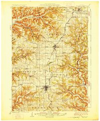
1926 Map of Viroqua
USGS Topo · Published 1926About this map
The driftless landscape of Vernon County is defined here by its intricate ridge-and-coulee topography, where early 20th-century life centered on a dense network of country schools and churches. Viroqua and Westby serve as the primary hubs along the Chicago Milwaukee and St Paul railroad, which follows the high ground of the watershed. Notable rural institutions include the Coon Prairie Church and the Vernon County Asylum, while numerous family-named schools like Lium School and Von Ruden School highlight the distributed nature of the era's farming communities. Deep valleys such as Bohemian Valley and Spring Coulee cut through the ridges, housing settlements like Springville and Avalanch. Distinctive landmarks like Chimney Rock stand out against the agricultural plateau, while the West Fork Kickapoo River and Fork Bad Axe River drain the eastern and western slopes respectively.
Find a feature on this map
87 named features on this map. Tap any name to fly to it.
Don’t see what you’re looking for? This feature index may not catch every label — zoom into the map to look around manually.
Map Details
Editions of this 1926 Viroqua Map
2 editions found
Other maps of this area

1903 · Waukon
USGS Topo · 1:125,000

1909 · Sparta
USGS Topo · 1:62,500

1916 · Tomah
USGS Topo · 1:62,500

1923 · Viroqua
USGS Topo · 1:62,500

1924 · Gays Mills
USGS Topo · 1:62,500

1926 · Gays Mills
USGS Topo · 1:62,500

1926 · Stoddard
USGS Topo · 1:62,500

1926 · La Farge
USGS Topo · 1:62,500

1927 · La Crosse
USGS Topo · 1:62,500

1929 · Ferryville
USGS Topo · 1:62,500