Old Maps of Vernon County, Wisconsin
Explore 166 old maps of Vernon County, spanning from 1903 to today. These high-resolution historic maps reveal how streets, neighborhoods, landmarks, and natural features evolved over time — perfect for genealogy, metal detecting, research, and local history exploration.
What you can do with these maps:
- See how Vernon County changed over time: Compare historical maps to modern-day views to trace roads, homesites, rail lines & more.
- View detailed metadata: Each map includes creators, publishers, year, scale, and archive source.
- Overlay maps with satellite & LiDAR: Visualize the past alongside modern tools to explore terrain & human change.
- Trusted historical sources: Maps sourced from the USGS, Library of Congress, and other archives.
- Access maps your way: View online, download high-res files, or order prints for personal or research use.
Start exploring old maps of Vernon County to uncover forgotten places, hidden landmarks, and the deep history beneath your feet.
Vernon County, WI maps
(166)- 1903 Map of Waukon
 1903 Waukon1903 Print · USGSThe Upper Mississippi River valley comes alive in the early 1900s, showing a landscape of steep bluffs, river landings, and early rail lines. You can trace the path of the Chicago Milwaukee and St. Paul RR to the county seat at Waukon or find old riverfront points like Harpers Ferry and Lansing.5 unique versions available
 - 1923 Map of Viroqua, 1960 Print
 1923 Viroqua1960 Print · USGSViroqua and the rural townships of Vernon and Monroe counties are shown in the early 1920s as a thriving network of ridge-top farms and valley schools. Genealogists can locate family landmarks like Wang Church, the Vernon County Asylum, and the Clockmaker School.
 - 1924 Map of Gays Mills, 1957 Print
 1924 Gays Mills1957 Print · USGSCrawford County's ridgelands and the Kickapoo River valley are captured in detail during the mid-twenties, showing the region's rural character before modern road realignment. Genealogists can locate dozens of country schoolhouses and churches, from Liberty Pole to the Nash Church, alongside family landmarks like Monument Rock.
 - 1926 Map of Gays Mills
 1926 Gays Mills1926 Print · USGSCrawford and Vernon Counties are captured during the mid-twenties when the Kickapoo River valley was a bustling rail corridor. Genealogists can trace hundreds of family-named features like Helgerson Ridge, McManus Valley, and many rural institutions including Evergreen Cemetery and the Southwest Prairie Church.
 - 1926 Map of Stoddard
 1926 Stoddard1926 Print · USGSUpper Mississippi river life and ridge-top farming meet in the mid-1920s along the Wisconsin-Minnesota border. Researchers can trace the complex river channels near Stoddard or find family roots at rural landmarks like Evening Star School and Romance.2 unique versions available
 - 1926 Map of Viroqua
 1926 Viroqua1926 Print · USGSThe ridge-and-valley country of Vernon County is captured in the mid-1920s, showing a landscape of small farms connected by a vast network of rural schools. Genealogists can trace hundreds of family sites near Clockmaker School, Moen Church, and the Vernon County Asylum.2 unique versions available
 - 1926 Map of La Farge
 1926 La Farge1926 Print · USGSThe Kickapoo River valley in the mid-1920s reveals a landscape of ridge-top farms and isolated coulee settlements. Genealogists can trace family footprints across dozens of local school sites like Johnniecake School and through the rail corridor of the Chicago Milwaukee and St Paul River.3 unique versions available
 - 1927 Map of Hillsboro
 1927 Hillsboro1927 Print · USGSThe Driftless Area landscape near the Vernon and Sauk county lines is captured here in the mid-1920s. Genealogists can locate dozens of country schoolhouses like Whiteoak Grove School and tracing the route of the Chicago and Northeastern RR.2 unique versions available
 - 1929 Map of Ferryville, 1957 Print
 1929 Ferryville1957 Print · USGSThe riverfront and ridge-top communities of Crawford and Vernon counties are captured here in the late 1920s before major lock and dam construction. Genealogists can locate family landmarks such as Freeman Church, Redmound School, and the riverside tracks of the Chicago Burlington and Quincy Railroad.2 unique versions available
 - 1932 Map of Ferryville
 1932 Ferryville1932 Print · USGSThe Mississippi River bottoms and the ridge-and-hollow country of western Wisconsin are captured here in the early 1930s. Genealogists can trace family farm locations near dozens of rural landmarks like Redmound School, Freeman Church, and Battle Slough.
 - 1933 Map of Boaz
 1933 Boaz1933 Print · USGSRichland and Vernon counties are shown in the early thirties as a landscape of steep ridges and school-rich valleys. Genealogists can trace family roots through dozens of rural schools and churches, from Rolling Ground and Jimtown to the Dieter Hollow Church.2 unique versions available
 - 1956 Map of Brownsville, 1958 Print
 1956 Brownsville1958 Print · USGSSoutheastern Minnesota and the Mississippi River bottoms are captured here in the mid-fifties, showing the region's transition from rural school districts. Researchers can trace dozens of family-named landmarks and closed schools like Peacock Ridge Sch (Abandoned) or visit St Peters Ch.2 unique versions available
 - 1958 Map of La Crosse, 1979 Print
 1958 La Crosse1979 Print · USGSThe Driftless Area of Wisconsin and Iowa is captured here during the late seventies, showing the intricate river valleys and ridge-top settlements. Genealogists and historians can trace the rail corridors of the Soo Line or locate landmarks like Grandad Bluff and Effigy Mounds National Monument.2 unique versions available
 - 1961 Map of La Crosse
 1961 La Crosse1961 Print · USGSThe Driftless Area at the start of the 1960s reveals a complex network of river towns and rail lines along the Mississippi River. Genealogists and historians can trace old settlements like New Amsterdam and Wyattville or locate major landmarks like Camp McCoy Military Reservation and Effigy Mounds National Monument.
 - 1965 Map of La Crosse
 1965 La Crosse1965 Print · USGSThe Driftless Area and the Upper Mississippi valley are captured here during a period of steady mid-century growth. Researchers can trace the rail lines of the Chicago and North Western or locate riverfront sites like Effigy Mounds National Monument and the Camp McCoy Military Reservation.
 - 1965 Map of La Farge, 1967 Print
 1965 La Farge1967 Print · USGSThe Kickapoo River valley and the ridges of Vernon County are captured here in the mid-sixties, showing a landscape defined by small-scale farming and winding valley roads. Researchers can trace rural lineages through numerous hilltop landmarks like Oak Ridge Ch, Potts Corners, and the Billings Creek Cem.
 - 1965 Map of Viroqua, 1967 Print
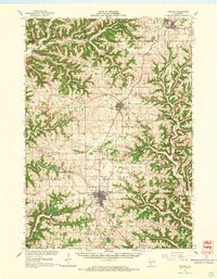 1965 Viroqua1967 Print · USGSVernon County ridge country is captured in the mid-1960s, showing the agricultural heart of the Driftless Area. Genealogists and historians can locate family landmarks like Bethel Ch Cem, rural schools such as Smith Sch, and the winding Kickapoo River valley.2 unique versions available
 - 1965 Map of Stoddard, 1968 Print
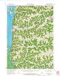 1965 Stoddard1968 Print · USGSWisconsin's driftless coulee country and the Mississippi River islands are captured here in the mid-sixties. Genealogists and local historians can trace rural family life through landmarks like St Peters Ch, North Ridge Sch, and the isolated German Cem.
 - 1966 Map of Gays Mills, 1968 Print
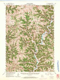 1966 Gays Mills1968 Print · USGSCrawford and Vernon counties in the mid-sixties show a landscape of steep ridges and winding river bottoms. Genealogists and historians can trace family roots through the Southwest Prairie Ch, the Rising Sun Sch, and small settlements like Petersburg and Fargo.
 - 1966 Map of Ferryville, 1968 Print
 1966 Ferryville1968 Print · USGSThe Mississippi River valley in the mid-sixties is shown in detail, capturing the intricate sloughs and ridges along the Wisconsin and Iowa border. Researchers can trace the riverfront rail lines and find small upland landmarks like Red Mound, Retreat, and Walnut Mound Cem.2 unique versions available
 - 1966 Map of Hillsboro, 1968 Print
 1966 Hillsboro1968 Print · USGSWisconsin's Driftless Area remains a maze of ridges and coulees in the mid-sixties, centered on the growing town of Hillsboro. Genealogists can locate family roots at the Bohemian Brotherhood Cem, County Corners Sch, or along the Chicago and North Western line.
 - 1966 Map of Boaz, 1968 Print
 1966 Boaz1968 Print · USGSRichland County's ridge-and-valley landscape is captured here in the mid-1960s, showing a network of rural settlements and family-named hollows. Researchers can trace local history through sites like Kickapoo Center Ch, Rolling Ground, and the Tavera Sch.
 - 1976 Map of La Crosse
 1976 La Crosse1976 Print · USGSThe Driftless Area and Mississippi River valley are captured here in the mid-seventies, showing a landscape of deep coulees and river commerce. Genealogists can trace family footprints from La Crosse to smaller hamlets like Newburg Corners and Witoka.
 - 1980 Map of Brownsville
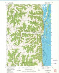 1980 Brownsville1980 Print · USGSThe Mississippi River valley near Brownsville comes alive in this 1980 survey, showing the intricate sloughs and ridges of the region. Trace local history at St Patricks Cem, Townhall, and along the Chicago Milwaukee St Paul and Pacific railroad.
 - 1980 Map of Reno
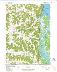 1980 Reno1980 Print · USGSThe bluffs of Houston County met the Mississippi backwaters in the late seventies, creating a landscape of deep timber and intricate sloughs. Genealogists and hikers can locate Winnebago Cem, the Church of Peace, and rail history along the Chicago Milwaukee St Paul and Pacific.
Showing maps 1-25 of 166
Top cities of Vernon County
- Viroqua historical maps
- Westby historical maps
- Hillsboro historical maps
- Greenwood historical maps
- Stoddard historical maps
- La Farge historical maps
See more
Frequently asked questions
- What are the different types of historical maps available for Vernon County?
- What is the oldest map of Vernon County?
- Where can I purchase historical maps of Vernon County for my home or office?
- Where can I download high-res historical maps of Vernon County?
- Are there historical topographic maps available for Vernon County?
- Is there historical aerial imagery available for Vernon County?
- Where are historical maps of Vernon County sourced from?