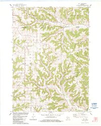
1980s Maps of Vernon County, Wisconsin
Explore 27 historic maps of Vernon County from the 1980s. These maps offer a rare glimpse into what life looked like during the 1980s — showing old roads, neighborhoods, homes, and landmarks that have changed or disappeared over time.
Whether you're researching your family's past, planning a metal detecting trip, or studying how Vernon County's landscape evolved across the 1980s, these high-resolution maps are a powerful tool for exploring the history of this region.
- Focus on a specific era: All maps on this page are from the 1980s, giving you a focused view of this time period.
- See what’s changed: Compare century-old streets, trails, and buildings to today's modern landscape using overlays and satellite layers.
- Research with precision: Use these maps for genealogy, historical research, land use analysis, or educational projects.
- View, download, or print: Maps are fully viewable online in high resolution, and can be downloaded or printed for your own records.
Start exploring Vernon County's history through authentic maps from the 1980s. This is your window into the past.
Vernon County, WI maps
(27)- 1980 Map of Brownsville
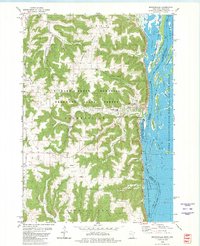 1980 Brownsville1980 Print · USGSThe Mississippi River valley near Brownsville comes alive in this 1980 survey, showing the intricate sloughs and ridges of the region. Trace local history at St Patricks Cem, Townhall, and along the Chicago Milwaukee St Paul and Pacific railroad.
 - 1980 Map of Reno
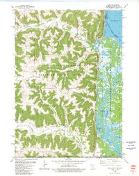 1980 Reno1980 Print · USGSThe bluffs of Houston County met the Mississippi backwaters in the late seventies, creating a landscape of deep timber and intricate sloughs. Genealogists and hikers can locate Winnebago Cem, the Church of Peace, and rail history along the Chicago Milwaukee St Paul and Pacific.
 - 1983 Map of Coon Valley
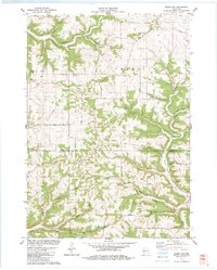
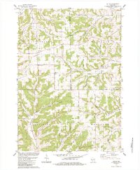
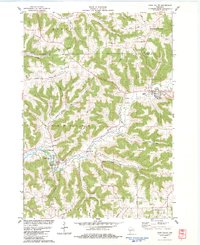 1983 Coon Valley1983 Print · USGSThe Driftless Area of western Wisconsin is shown here in the early 1980s, featuring the ridge-and-valley terrain of the Vernon County border. Researchers can trace rural lineages at the Middle Coon Valley Cem or locate the Chaseburg Sch and Wayside Park.
 - 1983 Map of Westby
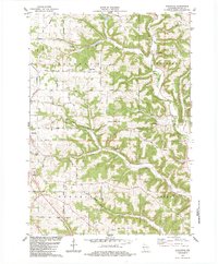
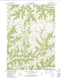
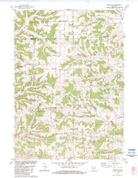
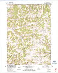
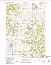 1983 Westby1983 Print · USGSThe ridge-and-valley country of Vernon and Monroe counties is captured here in the early eighties. Genealogists can trace family lines at Coon Prairie Ch and Pleasant View Cem, or locate landmarks like the Ski Jumps and Living Waters Camp.2 unique versions available
 - 1983 Map of Newton
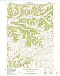
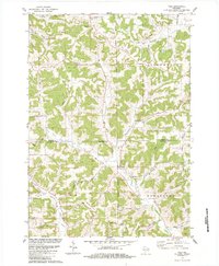
 1983 Newton1983 Print · USGSNewton and the surrounding Vernon County ridges are shown in high detail during the early eighties. Genealogists and local historians can trace family-named landmarks like Lars Anderson Hollow and rural congregations at Zion Ch or Bad Axe Ch.
 - 1983 Map of Avalanche
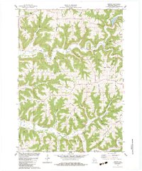
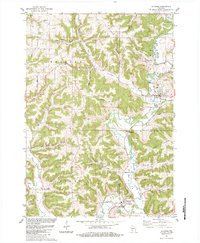
 1983 Avalanche1983 Print · USGSVernon County ridge country is captured here in the early eighties, showing the deeply etched valleys of the Kickapoo River system. Researchers can locate numerous family burial grounds including Asbury Ridge Cem, White Cem, and Brookville Cem.2 unique versions available
 - 1983 Map of Rising Sun
 1983 Rising Sun1983 Print · USGSThe Vernon and Crawford County borderlands come to life in the early 1980s, showing a landscape of ridge-top settlements and winding valley roads. Genealogists and researchers can trace local family landmarks and community centers like St James Ch, Towerville, and Monument Rock.
 - 1983 Map of Readstown
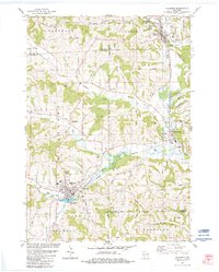
 1983 Readstown1983 Print · USGSThe Kickapoo River valley in the early 1980s reveals a landscape of high ridges and deep hollows. Genealogists can trace family roots through several rural sites like Kickapoo Ch, Fortney Cem, and the settlement of Folsom.
 - 1983 Map of Retreat
 1983 Retreat1983 Print · USGSThe ridge-and-valley landscape of Vernon County is captured here in the early eighties as a network of rural farmsteads and ridgetop roads. Researchers can trace family history through Retreat, the Freeman Church, and the Walnut Mound Cemetery.
 - 1983 Map of Stoddard
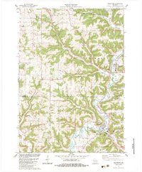
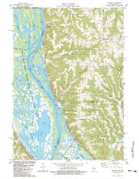
 1983 Stoddard1983 Print · USGSThe Mississippi River bluffs and deep coulees of Vernon County are captured here in the early 1980s. Genealogists and local historians can trace family-named landmarks and rural congregations like St Matthews Cem Ch, Proksch Coulee, and Lower Coon Valley Ch.
 - 1983 Map of Genoa
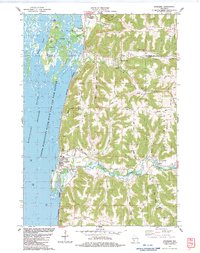
 1983 Genoa1983 Print · USGSGenoa and the Mississippi River backwaters are captured in the early eighties as the river's industrial and natural worlds coexist. Local historians can trace the foundations of St Johns Ch, the operations of Lock and Dam No 8, and numerous family landmarks like Johnson Ridge.
 - 1983 Map of Viroqua
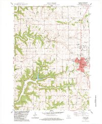 1983 Viroqua1983 Print · USGSIn the early 1980s, the driftless hills of Vernon County were a network of ridge-top farms and valley settlements. Genealogists can trace family names and locations at Pioneer Cem, Bethel Ch, and the County Farm Cem near Viroqua.2 unique versions available
 - 1983 Map of Esofea
 1983 Esofea1983 Print · USGSVernon County's coulee country in the early eighties shows a landscape of deep valleys and high ridges settled by farming families. Genealogists can trace local roots through landmarks like Skogdalen Ch, the Pumpkin Hollow area, and the small settlement of Esofea.2 unique versions available
 - 1983 Map of De Soto
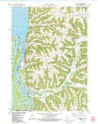
 1983 De Soto1983 Print · USGSThe riverfront settlements of De Soto and Victory sit at the base of dramatic bluffs in the early 1980s. Researchers can trace the dual rail lines of the Burlington Northern and Chicago Milwaukee St Paul and Pacific or find rural landmarks like Lawrence Ridge Cem.
 - 1983 Map of Sugar Grove
 1983 Sugar Grove1983 Print · USGSThe Kickapoo River valley in the early 1980s reveals a landscape of high ridges and winding hollows at the junction of three counties. Trace family history at Sugar Grove or Kickapoo Center and locate rural landmarks like Berry Cem and Kickapoo High Sch.
 - 1983 Map of Ontario, 1984 Print
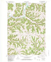
 1983 Ontario1984 Print · USGSThe Driftless Area landscape near the Monroe and Vernon county line shows its intricate valley network in the early 1980s. Researchers can locate the village of Ontario, remote burial sites like Calvin-Day Cem, and the boundaries of Wildcat Mountain State Park.
 - 1983 Map of La Farge, 1984 Print
 1983 La Farge1984 Print · USGSThe Kickapoo Valley in the early eighties was a landscape of high ridges and tight hollows centered on La Farge and Viola. Researchers can trace old transportation routes like the Old Railroad Grade and locate ancestral sites at Star Cem or Chapel Hill Cem.
 - 1983 Map of Trippville, 1984 Print
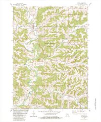
 1983 Trippville1984 Print · USGSThe ridge-and-valley country of Vernon County is shown here in the early eighties, where farming communities cling to the high ground. Genealogists can trace family footprints through numerous burial sites including Bohemian Brotherhood Cem, Mt Tabor Cem, and Revels Cem.
 - 1983 Map of Yuba, 1984 Print
 1983 Yuba1984 Print · USGSRichland and Vernon Counties appear here in the early 1980s, showcasing a landscape of deep coulees and ridge-top farms. Researchers can trace ancestral sites like Czechs National Cem and the settlement at White City along the Pine River.
 - 1983 Map of Valton, 1984 Print
 1983 Valton1984 Print · USGSThe tri-county border of Richland, Vernon, and Sauk counties comes into focus in the early 1980s, showcasing a landscape of high ridges and rural valleys. Researchers can trace family history at St Patricks Ch or locate family-named features like Benders Corners and Soules Creek.
 - 1983 Map of West Lima, 1984 Print
 1983 West Lima1984 Print · USGSThe Driftless Area of Vernon and Richland counties comes into focus in the early 1980s, showcasing the high-ridge farmsteads and narrow valleys of the Kickapoo region. Trace family history and rural routes through West Lima, Camp Creek Cem, and Maple Ridge.
 - 1983 Map of Dell, 1984 Print
 1983 Dell1984 Print · USGSVernon County and the Driftless Area topography are captured here in the early eighties. Genealogists can locate family-named landmarks like Potts Corners or trace rural community centers including Sugar Grove Ch and the Bad Axe Cem.
 - 1983 Map of Hillsboro, 1984 Print
 1983 Hillsboro1984 Print · USGSWisconsin’s driftless landscape at the start of the 1980s reveals a network of river-valley towns connected by rail and ridge roads. Genealogists and local historians can trace rural roots through St Patricks Cem, Hills Prairie Cem, and landmarks like Tinkers Bluff.
 - 1984 Map of La Crosse, 1985 Print
 1984 La Crosse1985 Print · USGSThe Driftless Area of the upper Mississippi valley appears here in the mid-eighties, showing the tri-state intersections of Wisconsin, Minnesota, and Iowa. Genealogists and local historians can trace family-named landmarks such as Peacock Ridge or Prosch Coulee and locate rural landmarks like St Marys Ch.
 - 1985 Map of Decorah
 1985 Decorah1985 Print · USGSNortheast Iowa and western Wisconsin in the mid-eighties show a landscape of high bluffs and river valleys shaped by the Upper Iowa and Mississippi Rivers. Genealogists and historians can trace the paths of the Chicago Milwaukee St Paul and Pacific railroad or locate the National Cemetery and the ancient earthworks at Effigy Mounds National Monument.2 unique versions available
Showing maps 1-25 of 27
Top cities of Vernon County
- Viroqua historical maps
- Westby historical maps
- Hillsboro historical maps
- Greenwood historical maps
- Stoddard historical maps
- La Farge historical maps
See more
Frequently asked questions
- What are the different types of historical maps available for Vernon County?
- What is the oldest map of Vernon County?
- Where can I purchase historical maps of Vernon County for my home or office?
- Where can I download high-res historical maps of Vernon County?
- Are there historical topographic maps available for Vernon County?
- Is there historical aerial imagery available for Vernon County?
- Where are historical maps of Vernon County sourced from?