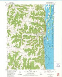
1980 Map of Brownsville
USGS Topo · Published 1980About this map
The Upper Mississippi River Wild Life and Fish Refuge dominates the eastern landscape of this 1980 survey, where the river's complex network of sloughs and islands creates a intricate watery border between Minnesota and Wisconsin. The settlement of Brownsville is positioned where the bluffs of the Richard J Dorer Memorial Hardwood State Forest meet the riverbank, served by the Chicago Milwaukee St Paul and Pacific railroad line.
Find a feature on this map
38 named features on this map. Tap any name to fly to it.
Don’t see what you’re looking for? This feature index may not catch every label — zoom into the map to look around manually.
Map Details
Editions of this 1980 Brownsville Map
This is the sole edition of this map. No revisions or reprints were ever made.
Other maps of this area

1926 · Stoddard
USGS Topo · 1:62,500

1927 · La Crosse
USGS Topo · 1:62,500

1930 · La Crescent
USGS Topo · 1:62,500

1930 · La Crosse
USGS Topo · 1:62,500

1956 · Brownsville
USGS Topo · 1:62,500

1956 · La Crescent
USGS Topo · 1:62,500

1958 · La Crosse
USGS Topo · 1:250,000

1961 · La Crosse
USGS Topo · 1:250,000
1963 · La Crosse
USGS Topo · 1:24,000
1963 · La Crosse
USGS Topo · 1:62,500