
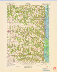
1956 Map of Brownsville
USGS Topo · Published 1958About this map
The Mississippi River corridor dominates the eastern edge of this mid-century survey, where the Chicago Milwaukee St Paul and Pacific railroad tracks hug the narrow shoreline beneath steep bluffs. Inland, the landscape is defined by an intricate network of ridges, including Peacock Ridge and Murphy Ridge, which separated the isolated farming communities and one-room schoolhouses of Houston County. The map documents a significant era of transition for rural education, marking dozens of closed local landmarks such as Stone Sch (Abandoned), Franklin Sch (Abandoned), and Steel Sch (Aban'd). While Caledonia and Brownsville serve as the primary hubs, the backcountry is dotted with historic congregational sites like Union Ridge Ch and the Church of Peace, reflecting the deeply rooted social fabric of these ridge-top settlements before modern consolidation.
Find a feature on this map
64 named features on this map. Tap any name to fly to it.
Don’t see what you’re looking for? This feature index may not catch every label — zoom into the map to look around manually.
Map Details
Editions of this 1956 Brownsville Map
2 editions found
Other maps of this area

1903 · Waukon
USGS Topo · 1:125,000

1906 · Decorah
USGS Topo · 1:125,000

1926 · Stoddard
USGS Topo · 1:62,500

1927 · La Crosse
USGS Topo · 1:62,500

1929 · Ferryville
USGS Topo · 1:62,500

1930 · La Crescent
USGS Topo · 1:62,500

1930 · La Crosse
USGS Topo · 1:62,500

1932 · Ferryville
USGS Topo · 1:62,500

1956 · La Crescent
USGS Topo · 1:62,500

1958 · Houston
USGS Topo · 1:62,500