2022 Map of Merton
USGS Topo · Published 2022About this map
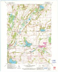
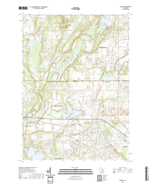
Glacial topography defines this corner of Waukesha County, where the Ice Age National Scenic Trail winds past a dense network of kettle lakes and river valleys. The landscape is anchored by significant local landmarks such as Holy Hill in the north and Lake Keesus at the center, surrounded by historic settlements including Monches, Merton, and North Lake. The map reveals a transition from these established village centers to modern residential clusters like Chenequa and Hartland in the south.
Find a feature on this map
64 named features on this map. Tap any name to fly to it.
Don’t see what you’re looking for? This feature index may not catch every label — zoom into the map to look around manually.
Map Details
Editions of this 2022 Merton Map
This is the sole edition of this map. No revisions or reprints were ever made.