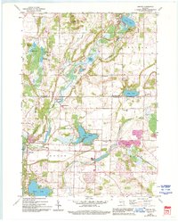
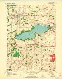
1959 Map of Merton
USGS Topo · Published 1994About this map
Holy Hill and the surrounding glaciated kettle landscape dominate this mid-century survey of the Washington and Waukesha County border. The map documents the intricate hydrology of the Oconomowoc River and Bark River systems, which connect a dense network of water bodies including Lake Keesus, Beaver Lake, and Friess Lake. This era shows the rural character of southeastern Wisconsin before late-century suburban expansion, evidenced by the distribution of small settlement clusters like Monches and Plat.
Find a feature on this map
47 named features on this map. Tap any name to fly to it.
Don’t see what you’re looking for? This feature index may not catch every label — zoom into the map to look around manually.
Map Details
Editions of this 1959 Merton Map
4 editions found
Other maps of this area

1892 · Waukesha
USGS Topo · 1:62,500

1892 · Oconomowoc
USGS Topo · 1:62,500

1901 · Waukesha
USGS Topo · 1:62,500

1904 · West Bend
USGS Topo · 1:62,500

1904 · Hartford
USGS Topo · 1:62,500

1906 · Waukesha
USGS Topo · 1:62,500

1909 · Oconomowoc
USGS Topo · 1:62,500

1957 · Madison
USGS Topo · 1:250,000

1959 · West Bend
USGS Topo · 1:62,500
1959 · Hartland
USGS Topo · 1:24,000