Loading...
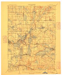
Loading map...1909 Map of Oconomowoc
USGS Topo · Published 1909About this map
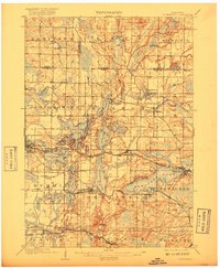
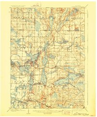
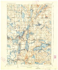
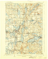
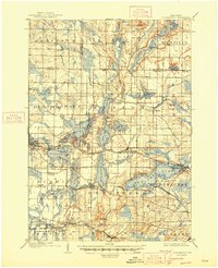
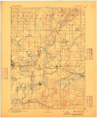
Holy Hill stands prominently in the northern reaches of this survey, overlooking a glacial landscape defined by dozens of kettle lakes and the winding Oconomowoc River. The early twentieth-century development of the region is centered on the Oconomowoc and Pewaukee Lake basins, where early tourism and established institutions take root. Prominent local landmarks include the historic Nashotah Mission and the State Fish Hatchery near Delafield, while the State Sanitarium is located to the south near Government Hill.
Find a feature on this map
80 named features on this map. Tap any name to fly to it.
Don’t see what you’re looking for? This feature index may not catch every label — zoom into the map to look around manually.
Map Details
Date Portrayed1909
Date Published1909
PublisherU.S. Geological Survey
Map TypeTopographic
Scale1:62,500
Physical Dimensions16.76 x 20.36 inches
Editions of this 1909 Oconomowoc Map
6 editions found
Historical Maps of Waukesha Through Time
4 maps found


Featured Locations
Source Details
SourceU.S. Geological Survey
CopyrightPublic Domain