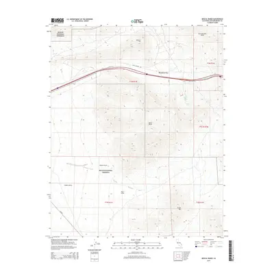
2015 Map of Mescal Range
USGS Topo · Published 2015About this map
Mountain Pass sits at the heart of this high-desert landscape, serving as a critical transit point where Interstate 15 cuts between the Clark Mountain Range and the Mescal Range. The map reveals the complex hydrology of the Mojave Desert, marked by isolated water sources such as Hardrock Queen Spring, Groaner Spring, and China Spring. Much of the southern and western portions of the sheet are protected within the Mojave National Preserve, which encompasses broad stretches of Shadow Valley and Piute Valley. The terrain is defined by dramatic elevation changes, rising from these low valleys up to prominent peaks like Mohawk Hill and Striped Mtn. This survey captures the modern infrastructure of San Bernardino County, including established desert routes like Cima Rd and Clark Mountain Rd, which provide access to this remote corner of California.
Find a feature on this map
22 named features on this map. Tap any name to fly to it.
Don’t see what you’re looking for? This feature index may not catch every label — zoom into the map to look around manually.
Map Details
Editions of this 2015 Mescal Range Map
This is the sole edition of this map. No revisions or reprints were ever made.
Other maps of this area

1910 · Ivanpah
USGS Topo · 1:250,000

1912 · Ivanpah
USGS Topo · 1:250,000

1942 · Ivanpah
USGS Topo · 1:250,000

1947 · Kingman
USGS Topo · 1:250,000

1948 · Kingman
USGS Topo · 1:250,000

1954 · Kingman
USGS Topo · 1:250,000

1955 · Kingman
USGS Topo · 1:250,000

1955 · Mescal Range
USGS Topo · 1:62,500

1955 · Roach Lake
USGS Topo · 1:62,500

1956 · Ivanpah
USGS Topo · 1:62,500