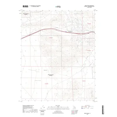
2018 Map of Mescal Range
USGS Topo · Published 2018About this map
Mountain Pass serves as the central focal point of this arid landscape, situated between the Clark Mountain Range to the north and the peaks of the Mescal Range to the south. This 2018 survey detail shows a high-desert environment within the Mojave National Preserve, where topographical relief is defined by prominent landmarks such as Mohawk Hill and Striped Mtn. The map traces vital water sources in this dry climate, including Hardrock Queen Spring, Groaner Spring, and China Spring. Transportation routes are sparse, dictated by the terrain, with Clark Mountain Rd and White Eagle Rd providing access across Piute Valley and Shadow Valley. The presence of Zinc Mine Rd near the Ivanpah Mountains reflects the region's enduring connection to mineral exploration and desert transit.
Find a feature on this map
23 named features on this map. Tap any name to fly to it.
Don’t see what you’re looking for? This feature index may not catch every label — zoom into the map to look around manually.
Map Details
Editions of this 2018 Mescal Range Map
This is the sole edition of this map. No revisions or reprints were ever made.
Other maps of this area

1910 · Ivanpah
USGS Topo · 1:250,000

1912 · Ivanpah
USGS Topo · 1:250,000

1942 · Ivanpah
USGS Topo · 1:250,000

1947 · Kingman
USGS Topo · 1:250,000

1948 · Kingman
USGS Topo · 1:250,000

1954 · Kingman
USGS Topo · 1:250,000

1955 · Kingman
USGS Topo · 1:250,000

1955 · Mescal Range
USGS Topo · 1:62,500

1955 · Roach Lake
USGS Topo · 1:62,500

1956 · Ivanpah
USGS Topo · 1:62,500