2022 Map of Middle Amana
USGS Topo · Published 2022About this map
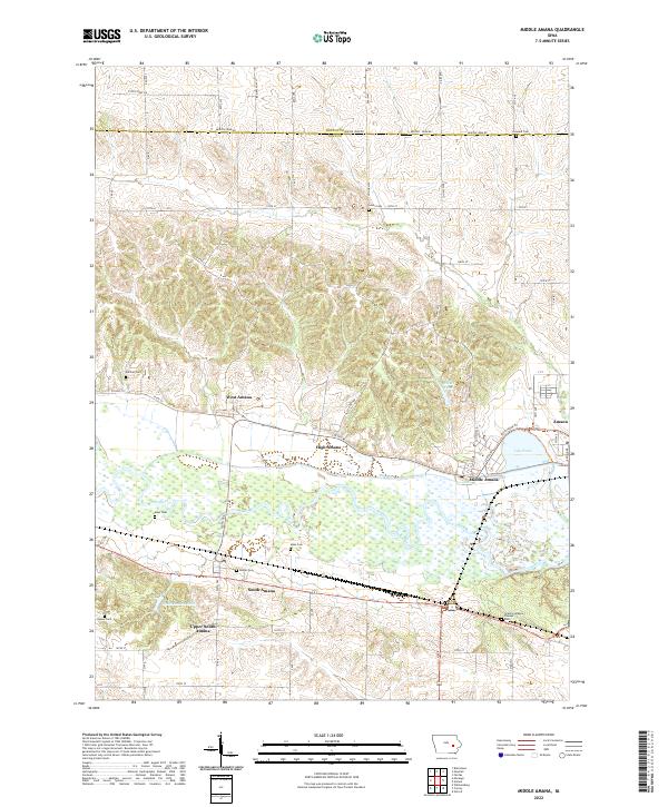
Middle Amana and its neighboring villages form a distinct pattern of communal settlement along the northern banks of the Iowa River. The landscape is defined by the sophisticated engineering of the Mill Race, a long waterway that bypasses river bends to connect West Amana, High Amana, and Middle Amana. Further east, Lily Pond and Middle Pond sit near the village of Amana, while the southern reaches contain South Amana and Upper South Amana. Local genealogy is well-documented through several family-named and community burial sites, including Granny Sprague Pioneer Cem and two separate locations for Maas Cem. The transition from the river valley to the higher ground of the Benton Co Iowa Co line is marked by a grid of rural roads like Benton Iowa Rd and Kolonieweg Trl, highlighting the region's enduring agricultural character.
Find a feature on this map
39 named features on this map. Tap any name to fly to it.
Don’t see what you’re looking for? This feature index may not catch every label — zoom into the map to look around manually.
Map Details
Editions of this 2022 Middle Amana Map
This is the sole edition of this map. No revisions or reprints were ever made.