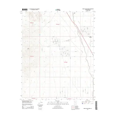
2014 Map of Middle Water Spring
USGS Topo · Published 2014About this map
Black Mountains dominate the western horizon of this high-desert landscape, where the rugged terrain transitions into the wide expanse of the Detrital Valley. Essential water sources such as Middle Water Spring and Kemple Spring are found along the mountain slopes, serving as critical landmarks in an arid environment. To the east, the settlement of Dolan Springs sits near the edge of the Mojave Desert, defined by a rigid grid of residential roads like Mineral Rd and Ruths Rd. The land is further shaped by the northward flow of Detrital Wash, which carves through the valley floor. This 2014 survey captures the distinct intersection of desert wilderness and rural development in Mohave County, illustrating how modern habitation patterns align with the traditional topography of the Arizona desert.
Find a feature on this map
57 named features on this map. Tap any name to fly to it.
Don’t see what you’re looking for? This feature index may not catch every label — zoom into the map to look around manually.
Map Details
Editions of this 2014 Middle Water Spring Map
This is the sole edition of this map. No revisions or reprints were ever made.
Other maps of this area

1886 · Camp Mohave
USGS Topo · 1:250,000

1892 · Camp Mohave
USGS Topo · 1:250,000

1926 · Nelson
USGS Topo · 1:96,000

1926 · Mohave City
USGS Topo · 1:96,000

1942 · Camp Mohave
USGS Topo · 1:250,000

1947 · Kingman
USGS Topo · 1:250,000

1948 · Kingman
USGS Topo · 1:250,000

1954 · Kingman
USGS Topo · 1:250,000

1955 · Kingman
USGS Topo · 1:250,000

1958 · Kingman
USGS Topo · 1:250,000