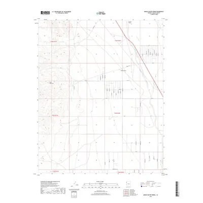
2018 Map of Middle Water Spring
USGS Topo · Published 2018About this map
Middle Water Spring and Kemple Spring provide essential water points in this arid landscape on the edge of the Black Mountains. The terrain transitions from high elevation in the west down toward the Detrital Valley, where the ephemeral Detrital Wash snakes northward through the Mojave Desert. This 2018 survey reveals a developing rural grid of residential roads east of the mountains, including Mineral Rd and N Star Rd. The presence of numerous named thoroughfares like Becky Rd, Jerry Rd, and Montgomery Ave suggests a sprawling settlement pattern or planned community layout in an area traditionally defined by its harsh desert environment and isolated springs.
Find a feature on this map
49 named features on this map. Tap any name to fly to it.
Don’t see what you’re looking for? This feature index may not catch every label — zoom into the map to look around manually.
Map Details
Editions of this 2018 Middle Water Spring Map
This is the sole edition of this map. No revisions or reprints were ever made.
Other maps of this area

1886 · Camp Mohave
USGS Topo · 1:250,000

1892 · Camp Mohave
USGS Topo · 1:250,000

1926 · Nelson
USGS Topo · 1:96,000

1926 · Mohave City
USGS Topo · 1:96,000

1942 · Camp Mohave
USGS Topo · 1:250,000

1947 · Kingman
USGS Topo · 1:250,000

1948 · Kingman
USGS Topo · 1:250,000

1954 · Kingman
USGS Topo · 1:250,000

1955 · Kingman
USGS Topo · 1:250,000

1958 · Kingman
USGS Topo · 1:250,000