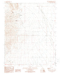
1989 Map of Middle Water Spring
USGS Topo · Published 1990About this map
Detrital Valley and the seasonal path of Detrital Wash dominate this arid landscape in Mohave County. In an environment where water sources dictated human activity, this 1989 survey records the presence of Middle Water Spring, Kemple Spring, and several other scattered springs, along with a functional Well and Water Tank. These vital points supported a local economy focused on ranching and small-scale prospecting, evidenced by the location of Cow Camp, a Corral, and the Kemple Camp site. The map reflects a long history of resource extraction, noting numerous Prospects, an Adit, and a Mine Shaft. A network of 4 WD trails provides the primary access through the desert floor, connecting isolated landmarks like the Ferry point and various Mine Shafts scattered across the foothills.
Find a feature on this map
22 named features on this map. Tap any name to fly to it.
Don’t see what you’re looking for? This feature index may not catch every label — zoom into the map to look around manually.
Map Details
Editions of this 1989 Middle Water Spring Map
This is the sole edition of this map. No revisions or reprints were ever made.
Other maps of this area

1886 · Camp Mohave
USGS Topo · 1:250,000

1892 · Camp Mohave
USGS Topo · 1:250,000

1926 · Nelson
USGS Topo · 1:96,000

1926 · Mohave City
USGS Topo · 1:96,000

1942 · Camp Mohave
USGS Topo · 1:250,000

1947 · Kingman
USGS Topo · 1:250,000

1948 · Kingman
USGS Topo · 1:250,000

1954 · Kingman
USGS Topo · 1:250,000

1955 · Kingman
USGS Topo · 1:250,000

1958 · Kingman
USGS Topo · 1:250,000