Loading...
Loading map...2024 Map of Middleton
USGS Topo · Published 2024About this map
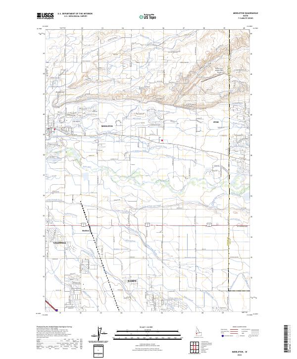
The Boise River valley serves as the central artery for this 2024 landscape, where the growing communities of Middleton, Star, and northern Nampa converge. The terrain is defined by an intricate network of irrigation engineering, essential for the region's agricultural history. Systems like the Caldwell High Line Canal, Farmers Union Canal, and Lawrence Kennedy Canal weave across the quadrangle, punctuated by numerous laterals and drains such as Phyllis Slough and Mason Slough.
Find a feature on this map
152 named features on this map. Tap any name to fly to it.
Don’t see what you’re looking for? This feature index may not catch every label — zoom into the map to look around manually.
Map Details
Date Portrayed2024
Date Published2024
PublisherU.S. Geological Survey
Map TypeTopographic
Scale1:24000
Physical Dimensions24 x 29 inches
Editions of this 2024 Middleton Map
This is the sole edition of this map. No revisions or reprints were ever made.
Historical Maps of Nampa Through Time
Featured Locations
Source Details
SourceU.S. Geological Survey
CopyrightPublic Domain