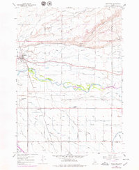
1958 Map of Middleton
USGS Topo · Published 1979About this map
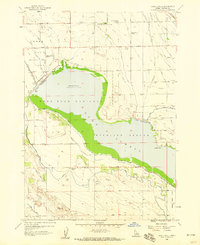
The Boise River valley south of McIntyre Hill reveals a landscape defined by an intricate network of irrigation and drainage in the mid-20th century. The town of Middleton serves as the primary hub, where the Union Pacific railroad corridor meets the historic Middleton Mill Slough. This survey illustrates the intensive engineering of the Snake River Plain, characterized by dozens of named waterways such as the Farmers Union Canal, Phyllis Slough, and Fifteenmile Creek. These features reflect the area's agricultural reliance on diverted river water to transform the desert terrain.
Find a feature on this map
56 named features on this map. Tap any name to fly to it.
Don’t see what you’re looking for? This feature index may not catch every label — zoom into the map to look around manually.
Map Details
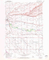
Editions of this 1958 Middleton Map
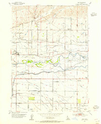
Other maps of this area

1892 · Boise
USGS Topo · 1:125,000

1897 · Boise
USGS Topo · 1:125,000

1898 · Nampa
USGS Topo · 1:125,000

1953 · Meridian
USGS Topo · 1:24,000
1953 · Star
USGS Topo · 1:24,000

1953 · Montour
USGS Topo · 1:62,500

1955 · Boise
USGS Topo · 1:250,000

1958 · Boise
USGS Topo · 1:250,000
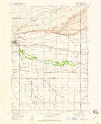
1958 · Middleton
USGS Topo · 1:24,000
1958 · Lake Lowell
USGS Topo · 1:24,000