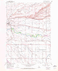
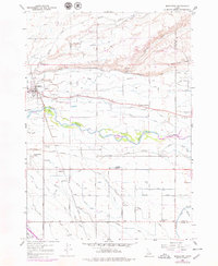
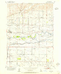
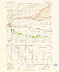
1958 Map of Middleton
USGS Topo · Published 1972About this map
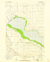
Middleton sits at a geographic crossroads in Canyon County, where the desert-edge slopes of McIntyre Hill meet the intensive irrigation networks of the valley. This 1958 survey, updated with 1971 aerial data, reveals a landscape defined by water management, featuring a dense grid of canals like the Caldwell Highline Canal and Highline Canal alongside the natural curves of the Boise River. The agricultural character of the era is evidenced by the distribution of rural landmarks, including the Franklin Labor Camp and several local centers of education such as Central Park Sch and Marble Front School. The Union Pacific rail line and the historic Foothill Road corridor provide the primary transit links between the scattered farmsteads and the emerging townsite. Local genealogists may find interest in the precise placement of the Lone Tree School and the recreational boundaries of Ward Mem State Park before the area's modern expansion.
Find a feature on this map
30 named features on this map. Tap any name to fly to it.
Don’t see what you’re looking for? This feature index may not catch every label — zoom into the map to look around manually.
Map Details
Editions of this 1958 Middleton Map
Other maps of this area

1892 · Boise
USGS Topo · 1:125,000

1897 · Boise
USGS Topo · 1:125,000

1898 · Nampa
USGS Topo · 1:125,000

1953 · Meridian
USGS Topo · 1:24,000
1953 · Star
USGS Topo · 1:24,000

1953 · Montour
USGS Topo · 1:62,500

1955 · Boise
USGS Topo · 1:250,000

1958 · Boise
USGS Topo · 1:250,000
1958 · Middleton
USGS Topo · 1:24,000
1958 · Lake Lowell
USGS Topo · 1:24,000