2022 Map of Middletown
USGS Topo · Published 2022About this map
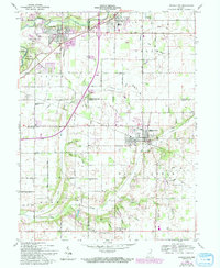
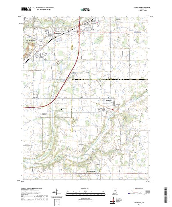
Middletown serves as a primary hub within this rural Indiana landscape, where the intersections of Henry, Madison, and Delaware counties meet. The area is defined by a dense network of family and community landmarks, particularly evident in the numerous burial grounds like Bronnenberg Cem near Chesterfield and Fattic Cem further south. The drainage patterns of Fall Creek and Sly Fork influence the local topography, carving paths through the agricultural grid. Aviation history is noted by the Anderson Municipal Airport-Darlington Field in the northwest corner, while smaller facilities like the Burk Personal Use Airport reflect the private infrastructure of the mid-20th century. The small settlement of Mechanicsburg sits at the southern edge, connected to the larger towns by a traditional grid of county roads that have guided local transit for generations.
Find a feature on this map
94 named features on this map. Tap any name to fly to it.
Don’t see what you’re looking for? This feature index may not catch every label — zoom into the map to look around manually.
Map Details
Editions of this 2022 Middletown Map
This is the sole edition of this map. No revisions or reprints were ever made.