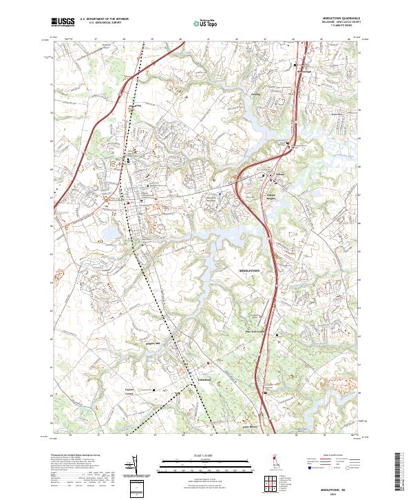
2023 Map of Middletown
USGS Topo · Published 2023About this map
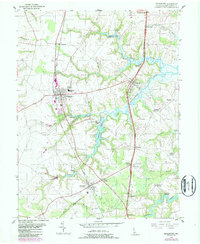
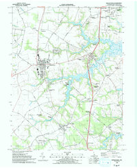
The Appoquinimink River and its numerous tributaries, including Drawyer Creek and Silver Lake, define the landscape of this southern New Castle County corridor. This modern survey illustrates the dense concentration of historical ecclesiastical sites and burial grounds that anchor the local heritage, from the centrally located Old Saint Anne's Church Cem to the split Old Drawyers Church Cem West and Old Drawyers Church Cem East near McDonough. The map documents the spatial relationship between the established town centers of Middletown, Townsend, and Odessa, as well as smaller historic settlements like Armstrong and Taylors Corner. Notable for genealogists and local historians are the numerous family-named landmarks and smaller aviation sites such as Mckeown Airport and Townsend A Airport that dot the agrarian and residential landscape between the river and the inland marshlands.
Find a feature on this map
228 named features on this map. Tap any name to fly to it.
Don’t see what you’re looking for? This feature index may not catch every label — zoom into the map to look around manually.
Map Details
Editions of this 2023 Middletown Map
This is the sole edition of this map. No revisions or reprints were ever made.
Historical Maps of Pine Tree Corners Through Time
3 maps found