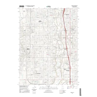
2017 Map of Midvale
USGS Topo · Published 2017About this map
The Jordan River valley corridor south of Salt Lake City is shown here as a dense network of suburban development and established townships. Major municipalities including West Jordan, South Jordan, Sandy, and Riverton are unified by a complex grid of numbered streets and historic water management systems. The agricultural roots of the valley are still visible in the paths of the Utah and Salt Lake Canal, Jordan and Salt Lake City Canal, and Provo Reservoir Canal, which once defined the irrigation patterns of the region. This 2017 survey documents the modern layout of several educational hubs, including the Salt Lake Community Coll Jordan Campus and the Salt Lake Community Coll Larry H Miller Campus. For genealogists and local historians, the map accurately positions several key burial grounds such as Wights Fort Cem, Crescent Cem, and the Midvale City Cem.
Find a feature on this map
120 named features on this map. Tap any name to fly to it.
Don’t see what you’re looking for? This feature index may not catch every label — zoom into the map to look around manually.
Map Details
Editions of this 2017 Midvale Map
This is the sole edition of this map. No revisions or reprints were ever made.
Other maps of this area

1885 · Salt Lake
USGS Topo · 1:250,000

1885 · Tooele Valley
USGS Topo · 1:250,000

1915 · Fairfield
USGS Topo · 1:62,500

1917 · Fairfield
USGS Topo · 1:62,500

1925 · Ft. Douglas
USGS Topo · 1:125,000

1928 · Ft. Douglas
USGS Topo · 1:125,000

1951 · Jordan Narrows
USGS Topo · 1:24,000

1951 · Lehi
USGS Topo · 1:24,000

1951 · Salt Lake City South
USGS Topo · 1:24,000

1951 · Midvale
USGS Topo · 1:24,000