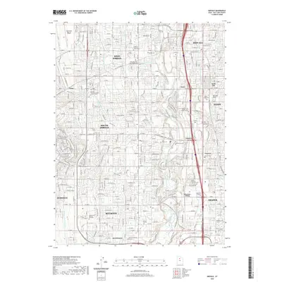
2020 Map of Midvale
USGS Topo · Published 2020About this map
The Jordan River carves a central path through this section of the Salt Lake Valley, anchoring a corridor of dense suburban development and institutional growth. The landscape is defined by the expansion of West Jordan, Midvale, and South Jordan, where residential grids meet a sophisticated network of canals like the Utah Lake Distributing Canal and Provo Reservoir Canal. This 2020 record illustrates a modern educational and civic hub, featuring campuses for Broadview University West Jordan, DeVry University Utah, and the Salt Lake Community College Jordan Campus. Genealogists will find a high concentration of burial sites, ranging from the historic Wights Fort Cem to the modern Lake Hills Memorial Estates. Transport patterns are marked by the Front Runner Blvd rail line and established points like Riverton Siding and Endot, reflecting the area's transition from an agricultural valley to a major metropolitan center.
Find a feature on this map
65 named features on this map. Tap any name to fly to it.
Don’t see what you’re looking for? This feature index may not catch every label — zoom into the map to look around manually.
Map Details
Editions of this 2020 Midvale Map
This is the sole edition of this map. No revisions or reprints were ever made.
Other maps of this area

1885 · Salt Lake
USGS Topo · 1:250,000

1885 · Tooele Valley
USGS Topo · 1:250,000

1915 · Fairfield
USGS Topo · 1:62,500

1917 · Fairfield
USGS Topo · 1:62,500

1925 · Ft. Douglas
USGS Topo · 1:125,000

1928 · Ft. Douglas
USGS Topo · 1:125,000

1951 · Jordan Narrows
USGS Topo · 1:24,000

1951 · Lehi
USGS Topo · 1:24,000

1951 · Salt Lake City South
USGS Topo · 1:24,000

1951 · Midvale
USGS Topo · 1:24,000