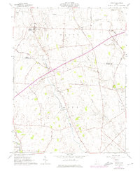
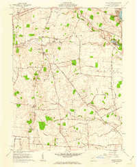
1961 Map of Midway
USGS Topo · Published 1975About this map
Midway serves as a primary settlement in this agricultural landscape within Range and Jefferson townships. The area is defined by the winding course of Paint Creek and its major tributary, the East Fork Paint Creek, which flow through the central and southern portions of the quadrangle. Local community life is anchored by historic gathering points such as Union Chapel and Bethel Church, with nearby burial grounds like Counts Cemetery and Yatesville Cemetery providing vital touchstones for genealogists tracing families in Madison and Fayette Counties.
Find a feature on this map
49 named features on this map. Tap any name to fly to it.
Don’t see what you’re looking for? This feature index may not catch every label — zoom into the map to look around manually.
Map Details
Editions of this 1961 Midway Map
2 editions found
Other maps of this area

1906 · Mt Sterling
USGS Topo · 1:62,500

1907 · London
USGS Topo · 1:62,500

1907 · South Charleston
USGS Topo · 1:62,500

1916 · Octa
USGS Topo · 1:62,500

1944 · Octa
USGS Topo · 1:62,500

1947 · Columbus
USGS Topo · 1:250,000

1961 · Columbus
USGS Topo · 1:250,000
1961 · Florence
USGS Topo · 1:24,000
1961 · Big Plain
USGS Topo · 1:24,000
1961 · Walnut Run
USGS Topo · 1:24,000