2024 Map of Midway
USGS Topo · Published 2024About this map
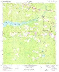
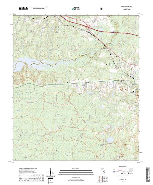
Midway stands as a central hub in Gadsden County, situated just north of the expansive Apalachicola National Forest. The landscape is defined by the winding Ochlockonee River, which feeds into the eastern reaches of Lake Talquin. This modern survey reveals a dense network of rural infrastructure, where family legacies are preserved in numerous small burial sites like the Adam Hunter Gravesite and Lockhart Jones Cem. The transition from the developed corridor of Midway to the managed timberlands of the national forest illustrates the region's balance between residential growth and conservation. Local congregations are well-documented, with the Ebenezer Baptist Church Cem and Bethel United Methodist Church Cem serving as significant landmarks for genealogists. The terrain is further etched by a complex drainage system including Midway Branch, Bradford Brook, and Polk Creek, which flow through the forested lowlands toward the river basin.
Find a feature on this map
98 named features on this map. Tap any name to fly to it.
Don’t see what you’re looking for? This feature index may not catch every label — zoom into the map to look around manually.
Map Details
Editions of this 2024 Midway Map
This is the sole edition of this map. No revisions or reprints were ever made.