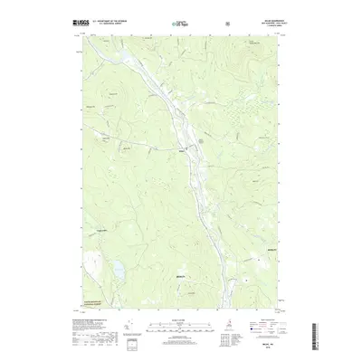
2018 Map of Milan
USGS Topo · Published 2018About this map
The Androscoggin River carves a central valley through this Coos County landscape, anchoring the settlement of Milan and the northern reaches of Berlin. This modern survey illustrates the infrastructure of a mountain economy, where the Berlin Regional Airport and a network of named logging and access roads like Success Rd and French Hill Rd navigate the high country. In the western portion of the map, the terrain rises sharply into the White Mountain National Forest, marked by the Milan Hill Fire Tower standing atop Milan Hill. Smaller hamlets like Copperville appear along the N Br Upper Ammonoosuc River, while the eastern peaks of Little Cambridge Mtn and Oak Hill overlook the winding Chickwolnepy Stream. This map details the modern balance of industrial park development and protected forest lands in northern New Hampshire.
Find a feature on this map
54 named features on this map. Tap any name to fly to it.
Don’t see what you’re looking for? This feature index may not catch every label — zoom into the map to look around manually.
Map Details
Editions of this 2018 Milan Map
This is the sole edition of this map. No revisions or reprints were ever made.
Other maps of this area

1893 · Mt. Washington
USGS Topo · 1:62,500

1893 · Gorham
USGS Topo · 1:62,500

1896 · Mt. Washington
USGS Topo · 1:62,500

1896 · Gorham
USGS Topo · 1:62,500

1930 · Milan
USGS Topo · 1:62,500

1930 · Percy
USGS Topo · 1:62,500

1933 · Milan
USGS Topo · 1:62,500

1934 · Percy
USGS Topo · 1:62,500

1934 · Milan
USGS Topo · 1:62,500

1935 · Mt. Washington
USGS Topo · 1:62,500