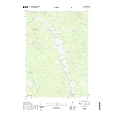
2021 Map of Milan
USGS Topo · Published 2021About this map
The Androscoggin River carves a deep valley through the northern White Mountains, anchoring the settlement of Milan and providing a natural corridor for Milan Rd. This landscape is defined by its dramatic relief, with prominent peaks like Milan Hill and Little Cambridge Mtn rising above the riverbanks. The valley floor supports essential local infrastructure, including the Berlin Regional Airport and Hillcrest Cem, while the surrounding uplands remain largely forested.
Find a feature on this map
62 named features on this map. Tap any name to fly to it.
Don’t see what you’re looking for? This feature index may not catch every label — zoom into the map to look around manually.
Map Details
Editions of this 2021 Milan Map
This is the sole edition of this map. No revisions or reprints were ever made.
Other maps of this area

1893 · Mt. Washington
USGS Topo · 1:62,500

1893 · Gorham
USGS Topo · 1:62,500

1896 · Mt. Washington
USGS Topo · 1:62,500

1896 · Gorham
USGS Topo · 1:62,500

1930 · Milan
USGS Topo · 1:62,500

1930 · Percy
USGS Topo · 1:62,500

1933 · Milan
USGS Topo · 1:62,500

1934 · Percy
USGS Topo · 1:62,500

1934 · Milan
USGS Topo · 1:62,500

1935 · Mt. Washington
USGS Topo · 1:62,500