2021 Map of Milford
USGS Topo · Published 2021About this map
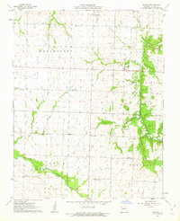
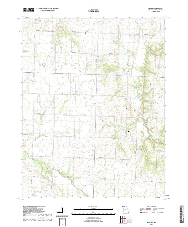
Milford is the primary settlement in this corner of Barton County, where the landscape is defined by the winding course of Horse Creek and the southern flow of the North Fork Spring River. The terrain is etched with numerous smaller waterways including McCarty Cr, Elm Br, and Painter Br, reflecting a region well-supplied with natural drainage. This survey documents a rural environment organized by a dense grid of township roads such as NE 80th Rd and State Hwy EE, which connect the scattered agricultural homesteads. Genealogists will find three distinct burial sites preserved on the landscape: Doylesport Cem in the north, and both Howell Cem and Cook Cem further south. The presence of Cass Lake near the center of the sheet provides a rare larger body of standing water amidst the predominantly riverine and creek-fed topography.
Find a feature on this map
36 named features on this map. Tap any name to fly to it.
Don’t see what you’re looking for? This feature index may not catch every label — zoom into the map to look around manually.
Map Details
Editions of this 2021 Milford Map
This is the sole edition of this map. No revisions or reprints were ever made.