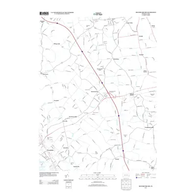
2013 Map of Milford Square
USGS Topo · Published 2013About this map
Spinnerstown and Milford Square anchor this 2013 survey of the Upper Bucks and Montgomery County borderlands, where the modern corridor of the Pennsylvania Turnpike intersects a network of colonial-era routes. The landscape is a mix of dense boroughs like Pennsburg and historic crossroads settlements including Geryville, Trumbauersville, and Finland. The map reveals the intricate drainage patterns of Unami Cr and Schmoutz Cr, which flow toward the Green Lane Reservoir in the south.
Find a feature on this map
254 named features on this map. Tap any name to fly to it.
Don’t see what you’re looking for? This feature index may not catch every label — zoom into the map to look around manually.
Map Details
Editions of this 2013 Milford Square Map
This is the sole edition of this map. No revisions or reprints were ever made.
Other maps of this area

1888 · Quakertown
USGS Topo · 1:62,500

1890 · Quakertown
USGS Topo · 1:62,500

1894 · Allentown
USGS Topo · 1:62,500

1894 · Quakertown
USGS Topo · 1:62,500

1902 · Boyertown
USGS Topo · 1:62,500

1902 · Slatington
USGS Topo · 1:62,500

1937 · Allentown West
USGS Topo · 1:48,000

1939 · Allentown
USGS Topo · 1:62,500

1942 · Norristown
USGS Topo · 1:125,000

1942 · Allentown West
USGS Topo · 1:62,500