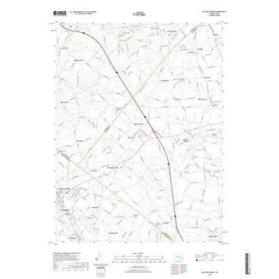
2019 Map of Milford Square
USGS Topo · Published 2019About this map
Spinnerstown and Milford Square anchor this Pennsylvania landscape where the borders of Lehigh, Bucks, and Montgomery counties converge. The area is defined by a dense network of country roads and local watercourses, including Unami Cr, Macoby Cr, and Molasses Cr. This 2019 survey documents a region with deep religious roots, evidenced by the high concentration of historic congregations such as the Kraussdale Meeting House and Cem, the Trinity Great Swamp United Church of Christ, and the Swamp Mennonite Church Cem. Aviation history is also represented by the presence of Quakertown Airport and the smaller Old Plains Airport. Throughout the quadrangle, smaller settlements like Geryville, Steinsburg, and Finland sit amidst a terrain of prominent rises like Chestnut Hill, preserving the spatial arrangement of these long-established southeastern Pennsylvania communities.
Find a feature on this map
222 named features on this map. Tap any name to fly to it.
Don’t see what you’re looking for? This feature index may not catch every label — zoom into the map to look around manually.
Map Details
Editions of this 2019 Milford Square Map
This is the sole edition of this map. No revisions or reprints were ever made.
Other maps of this area

1888 · Quakertown
USGS Topo · 1:62,500

1890 · Quakertown
USGS Topo · 1:62,500

1894 · Allentown
USGS Topo · 1:62,500

1894 · Quakertown
USGS Topo · 1:62,500

1902 · Boyertown
USGS Topo · 1:62,500

1902 · Slatington
USGS Topo · 1:62,500

1937 · Allentown West
USGS Topo · 1:48,000

1939 · Allentown
USGS Topo · 1:62,500

1942 · Norristown
USGS Topo · 1:125,000

1942 · Allentown West
USGS Topo · 1:62,500