2021 Map of Millard
USGS Topo · Published 2021About this map
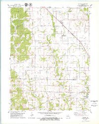
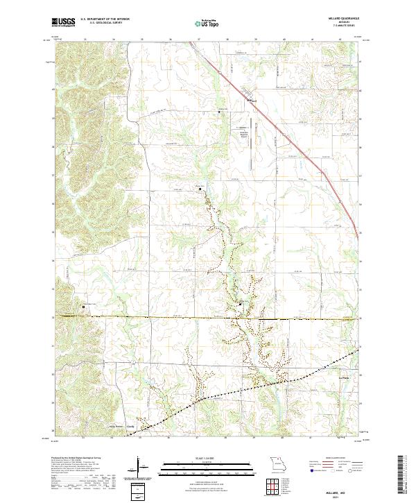
The E Fork Little Chariton River winds through this rural landscape, marking the topographic character of the border between Adair and Macon counties. Small farming communities and historic burials define the region, with the settlement of Millard situated in the north along Highway 63. Genealogists will find a high concentration of family-named burial grounds, including Stukey Cem, Shaver Cem, Shoemaker Cem, and Bragg Cem, often accessed by dedicated paths like Stukey Cemetery Trl. In the southern portion of the sheet, the terrain transitions toward La Plata and the small whistle-stop area of Cardy, while the Kirksville Regional Airport stands as a modern landmark. Numerous waterways, such as Richland Cr and Sugar Cr, intersect the grid of county roads, illustrating the drainage patterns of this agricultural corridor.
Find a feature on this map
69 named features on this map. Tap any name to fly to it.
Don’t see what you’re looking for? This feature index may not catch every label — zoom into the map to look around manually.
Map Details
Editions of this 2021 Millard Map
This is the sole edition of this map. No revisions or reprints were ever made.