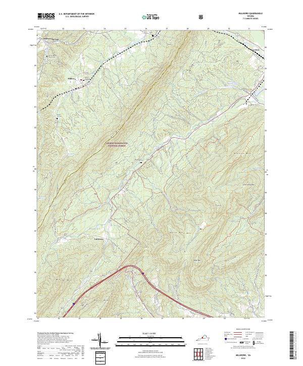
2022 Map of Millboro
USGS Topo · Published 2022About this map
Millboro and Millboro Springs anchor this portion of the Alleghany Mountains, situated within the George Washington National Forest along the border of Bath and Rockbridge counties. The landscape is defined by parallel ridges including Mill Mtn, Bratton Mtn, and the formidable North Mtn, which create deep valleys for waterways like Brattons Run and Mill Creek. This map reveals a high density of small family and community burial grounds, such as Tunnel Hill Cem and The Pines Cem, often located on the lower slopes near historical roadbeds. Settlement patterns follow these narrow gaps, with places like Goshen and California emerging where the terrain allows for transit. Modern infrastructure like US Hwy 60 and the W Midland Trl now traverse the same corridors that long supported the region's rural economy, while Cold Sulpher Springs Lake serves as a prominent landmark in the northeast.
Find a feature on this map
63 named features on this map. Tap any name to fly to it.
Don’t see what you’re looking for? This feature index may not catch every label — zoom into the map to look around manually.
Map Details
Editions of this 2022 Millboro Map
This is the sole edition of this map. No revisions or reprints were ever made.
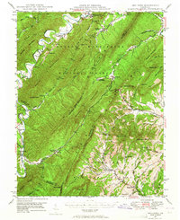
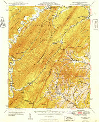
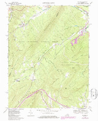
Historical Maps of Millboro Springs Through Time
4 maps found