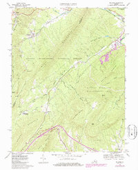
1969 Map of Millboro
USGS Topo · Published 1986About this map
The Chesapeake and Ohio railroad cuts a critical path through this mountain landscape, requiring significant engineering feats such as the Millboro Tunnel and Lick Run Tunnel to navigate the steep terrain of Mill Mountain. In the late 1960s, the village of Millboro remains a focal point near the High Sch, while the nearby Millboro Springs serves as a northern gateway. The southern portion of the map is dominated by the George Washington National Forest and the Goshen Wildlife Management Area, highlighting a region transitioning from early industrial activity to conservation and recreation. Notable historical sites include the Rockbridge Alum Springs and Camp Alkulana, reflecting the area's legacy as a destination for mineral springs and mountain retreats. Small settlements like California and Goshen dot the valleys where Brattons Run and the Calfpasture River converge.
Find a feature on this map
44 named features on this map. Tap any name to fly to it.
Don’t see what you’re looking for? This feature index may not catch every label — zoom into the map to look around manually.
Map Details
Editions of this 1969 Millboro Map
3 editions found
Other maps of this area

1894 · Staunton
USGS Topo · 1:125,000

1894 · Natural Bridge
USGS Topo · 1:125,000

1894 · Lexington
USGS Topo · 1:125,000

1901 · Monterey
USGS Topo · 1:125,000

1932 · Lexington
USGS Topo · 1:48,000

1937 · Lexington
USGS Topo · 1:62,500

1943 · Craigsville
USGS Topo · 1:62,500

1945 · Craigsville
USGS Topo · 1:62,500

1946 · Millboro
USGS Topo · 1:62,500

1946 · Williamsville
USGS Topo · 1:62,500