1946 Map of Millboro
USGS Topo · Published 1957About this map
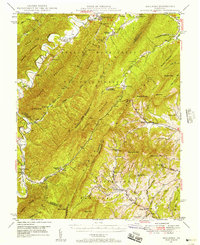
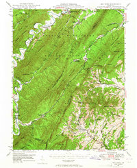
Nimrod Hall and Millboro anchor this topographic view of the Alleghany and Rockbridge county borders during the mid-1940s. The landscape is defined by the massive ridges of Rough Mountain and Bratton Mountain, where the Chesapeake and Ohio RR navigates the narrow valleys and piercing the heights through the Lick Run Tunnel and Mason Tunnel. The area's industrial and social history is visible in the presence of Long Dale Furnace on Long Dale Creek and the resort grounds of Rockbridge Alum Springs deep within the George Washington National Forest. Down in the lower valleys, small agricultural and social hubs like Collierstown and Goshen are mapped alongside rural landmarks like Sharon Sch and Calvary Ch. The detailed mapping of the Cowpasture River and its numerous tributaries reveals a complex network of drafts and hollows that shaped early settlement patterns and transportation routes.
Find a feature on this map
83 named features on this map. Tap any name to fly to it.
Don’t see what you’re looking for? This feature index may not catch every label — zoom into the map to look around manually.
Map Details
Editions of this 1946 Millboro Map
2 editions found
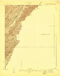
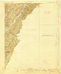
Other maps of this area

1894 · Staunton
USGS Topo · 1:125,000

1894 · Natural Bridge
USGS Topo · 1:125,000

1894 · Lexington
USGS Topo · 1:125,000

1894 · Natural Bridge
USGS Topo · 1:62,500

1901 · Monterey
USGS Topo · 1:125,000

1907 · Natural Bridge Special
USGS Topo · 1:62,500

1913 · Eagle Rock
USGS Topo · 1:48,000

1915 · Eagle Rock
USGS Topo · 1:62,500
1923 · Warm Springs
USGS Topo · 1:48,000
1926 · Warm Springs
USGS Topo · 1:62,500