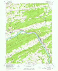
2023 Map of Millerstown
USGS Topo · Published 2023About this map
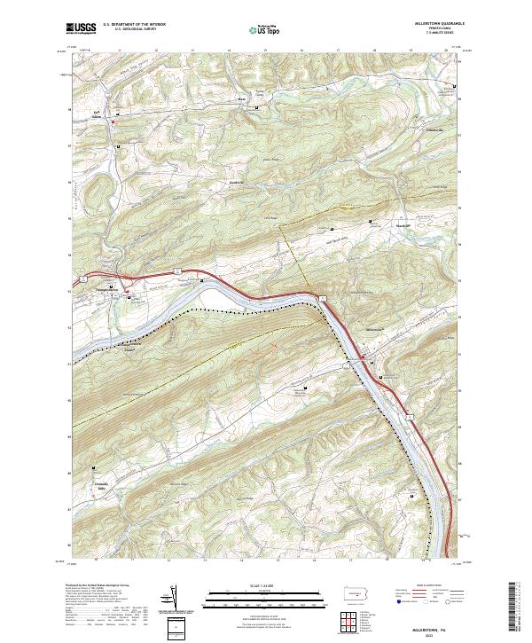
The Juniata River and the historical corridor of the Pennsylvania Canal anchor this detailed study of the Perry and Juniata County border. The landscape is defined by the rhythmic ridges and valleys of the Appalachian Mountains, including the prominent Tuscarora Mountain and the distinct Wildcat Ridge. This topography has long dictated the path of transportation, from the river and canal to the modern Norfolk Southern railway and the William Penn Highway. Settlement patterns follow these routes, centering on Millerstown and Thompson Town. Genealogy and local history researchers will find a significant concentration of burial grounds, such as Saint Stephens Episcopal Cem and the Whiteland Church Cem, alongside industrial markers like Donnally Mills and the remains of the canal infrastructure at Thompson's Lock Cem.
Find a feature on this map
99 named features on this map. Tap any name to fly to it.
Don’t see what you’re looking for? This feature index may not catch every label — zoom into the map to look around manually.
Map Details
Editions of this 2023 Millerstown Map
This is the sole edition of this map. No revisions or reprints were ever made.
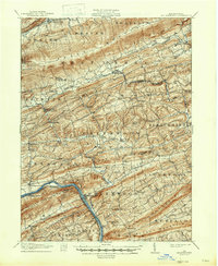
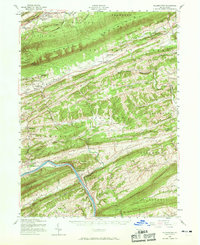
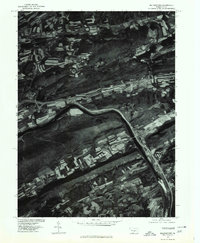
Historical Maps of Millerstown Through Time
6 maps found