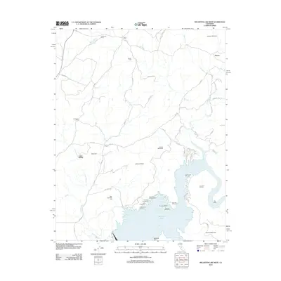
2012 Map of Millerton Lake West
USGS Topo · Published 2012About this map
Millerton Lake anchors the southern portion of this landscape, where the waters of the San Joaquin River are held by the Friant Dam. The shoreline is characterized by complex inlets and recreation sites, including Dumna Cove and Winchell Bay, as well as numerous campgrounds like Mono Campground and Rocky Point Campground. To the north, the terrain transitions into a series of ridges and peaks, most notably Millerton Ridge and the oddly named Tick-Tack-Toe Hill.
Find a feature on this map
58 named features on this map. Tap any name to fly to it.
Don’t see what you’re looking for? This feature index may not catch every label — zoom into the map to look around manually.
Map Details
Editions of this 2012 Millerton Lake West Map
This is the sole edition of this map. No revisions or reprints were ever made.
Other maps of this area

1912 · Mariposa
USGS Topo · 1:125,000

1916 · Sulphur Springs
USGS Topo · 1:24,000

1919 · Sulphur Springs
USGS Topo · 1:31,680

1919 · Little Table Mountain
USGS Topo · 1:31,680

1922 · Lanes Bridge
USGS Topo · 1:31,680

1922 · Friant
USGS Topo · 1:31,680

1923 · Academy
USGS Topo · 1:31,680

1942 · Raymond
USGS Topo · 1:62,500

1942 · Little Table Mountain
USGS Topo · 1:24,000

1942 · Millerton Lake
USGS Topo · 1:62,500