2022 Map of Milliken
USGS Topo · Published 2022About this map
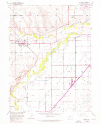
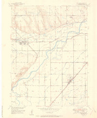
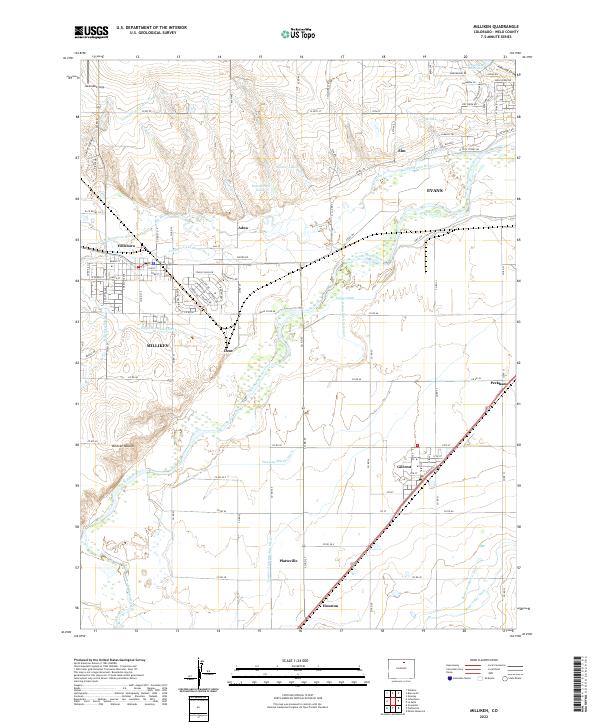
The confluence of the Big Thompson River and the Little Thompson River near Hillsboro defines the western landscape of this agricultural region. Extensive irrigation infrastructure, including the Thompson-and-Platte Ditch and the Hillsboro Ditch, supports the local economy and connects the small hubs of Milliken and Dent. To the east, the South Platte River winds through the terrain, flanked by intensive water management features like the Godfrey Ditch and the Western Mutual Ditch. The presence of small settlements such as Gilcrest, Peckham, and Houston along the southern rail corridor highlights the area's historical reliance on transport and water. Significant local landmarks, such as Wildcat Mound and several reservoirs like Spomer Lakes and Kammerzell Lake, punctuate the rural sections between the primary river valleys.
Find a feature on this map
67 named features on this map. Tap any name to fly to it.
Don’t see what you’re looking for? This feature index may not catch every label — zoom into the map to look around manually.
Map Details
Editions of this 2022 Milliken Map
This is the sole edition of this map. No revisions or reprints were ever made.