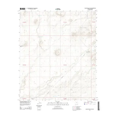
2014 Map of Million Dollar Tank
USGS Topo · Published 2014About this map
San Bernardino Valley dominates this landscape in southeastern Cochise County, where water resources were vital for regional ranching operations. The presence of the Million Dollar Tank and Mormon Tanks indicates a history of managed water in an arid environment. These artificial and natural catchments supported the local cattle industry, linked by desert thoroughfares such as E Geronimo Trl and E Lazy J Ranch Rd. The drainage patterns of Cottonwood Cr, Sycamore Cr, and Hay Hollow Wash illustrate the complex hydrography that defines the terrain. This survey reflects the persistence of ranching infrastructure and names in the borderlands, providing a clear view of the roads and water tanks that allowed these remote valleys to be settled and worked.
Find a feature on this map
19 named features on this map. Tap any name to fly to it.
Don’t see what you’re looking for? This feature index may not catch every label — zoom into the map to look around manually.
Map Details
Editions of this 2014 Million Dollar Tank Map
This is the sole edition of this map. No revisions or reprints were ever made.
Other maps of this area

1917 · Chiricahua
USGS Topo · 1:125,000

1919 · Perilla
USGS Topo · 1:125,000

1919 · Chiricahua
USGS Topo · 1:125,000

1922 · McDonald
USGS Topo · 1:62,500

1926 · Pedregosa
USGS Topo · 1:62,500

1940 · Apache
USGS Topo · 1:62,500

1940 · College Peaks
USGS Topo · 1:62,500

1955 · Douglas
USGS Topo · 1:250,000

1958 · Apache
USGS Topo · 1:62,500

1958 · Guadalupe Canyon
USGS Topo · 1:62,500