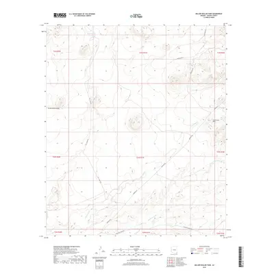
2018 Map of Million Dollar Tank
USGS Topo · Published 2018About this map
San Bernardino Valley dominates this corner of Cochise County, where the landscape is defined by the drainage patterns of Cottonwood Cr and Hay Hollow Wash. The map reveals a ranching economy sustained by scattered water sources like Mormon Tanks in the northern reach. Transportation in this high desert environment relies on a network of long-established tracks and ranch roads, including the historic Geronimo Trl cutting diagonally across the terrain. Specific holdings such as the Fairchild Ranch are accessible via named corridors like Snare Ranch Rd and Lazy J Ranch Rd, providing a clear record of land use and property boundaries in this part of southern Arizona. The southern boundary is marked by Guadalupe Canyon Rd as it approaches the international border region.
Find a feature on this map
19 named features on this map. Tap any name to fly to it.
Don’t see what you’re looking for? This feature index may not catch every label — zoom into the map to look around manually.
Map Details
Editions of this 2018 Million Dollar Tank Map
This is the sole edition of this map. No revisions or reprints were ever made.
Other maps of this area

1917 · Chiricahua
USGS Topo · 1:125,000

1919 · Perilla
USGS Topo · 1:125,000

1919 · Chiricahua
USGS Topo · 1:125,000

1922 · McDonald
USGS Topo · 1:62,500

1926 · Pedregosa
USGS Topo · 1:62,500

1940 · Apache
USGS Topo · 1:62,500

1940 · College Peaks
USGS Topo · 1:62,500

1955 · Douglas
USGS Topo · 1:250,000

1958 · Apache
USGS Topo · 1:62,500

1958 · Guadalupe Canyon
USGS Topo · 1:62,500