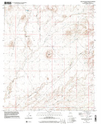
1996 Map of Million Dollar Tank
USGS Topo · Published 2003About this map
The San Bernardino Valley landscape dominates this mid-1990s survey of Cochise County, defined by a complex network of ephemeral drainage systems. The northern reaches are marked by Mormon Tanks and the eponymous Million Dollar Tank, critical water infrastructure in this arid environment. The terrain is shaped by the parallel courses of Black Draw and Cottonwood Draw, which cut through the high desert floor. Notable human modifications to this remote area include a remote Landing Strip and several Corral sites, indicating the continued importance of ranching operations. Significant landmarks like Wildcat Hill rise above the drainage basins of Sycamore Creek and Hay Hollow Wash, providing a clear view of the geographic transition as the land slopes toward the Mexican border.
Find a feature on this map
11 named features on this map. Tap any name to fly to it.
Don’t see what you’re looking for? This feature index may not catch every label — zoom into the map to look around manually.
Map Details
Editions of this 1996 Million Dollar Tank Map
This is the sole edition of this map. No revisions or reprints were ever made.
Other maps of this area

1917 · Chiricahua
USGS Topo · 1:125,000

1919 · Perilla
USGS Topo · 1:125,000

1919 · Chiricahua
USGS Topo · 1:125,000

1922 · McDonald
USGS Topo · 1:62,500

1926 · Pedregosa
USGS Topo · 1:62,500

1940 · Apache
USGS Topo · 1:62,500

1940 · College Peaks
USGS Topo · 1:62,500

1955 · Douglas
USGS Topo · 1:250,000

1958 · Apache
USGS Topo · 1:62,500

1958 · Guadalupe Canyon
USGS Topo · 1:62,500