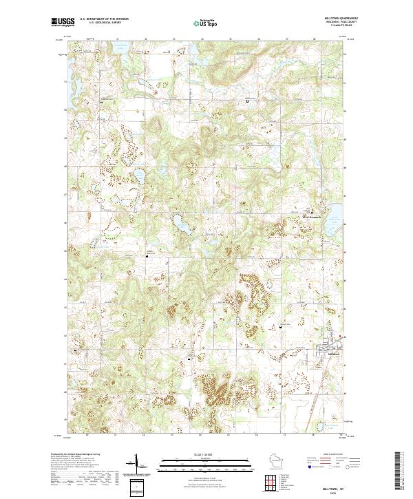
2022 Map of Milltown
USGS Topo · Published 2022About this map
The village of Milltown serves as the primary hub of this northwestern Wisconsin landscape, where the street grid of Main St W and Bank St transitions into a terrain defined by glacial remains. The area is dotted with numerous kettle lakes and wetlands, including Long Trade Lake, Bullhead Lake, and Little Butternut Lake, which are interconnected by the meandering Trade River. A strong legacy of early settlement is evident in the high density of small rural cemeteries like West Denmark Cem, Granum Cem, and North Valley Cem, marking the family lineages of the surrounding townships.
Find a feature on this map
52 named features on this map. Tap any name to fly to it.
Don’t see what you’re looking for? This feature index may not catch every label — zoom into the map to look around manually.
Map Details
Editions of this 2022 Milltown Map
This is the sole edition of this map. No revisions or reprints were ever made.
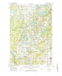
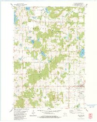
Historical Maps of Milltown Through Time
4 maps found