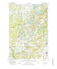
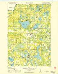
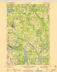
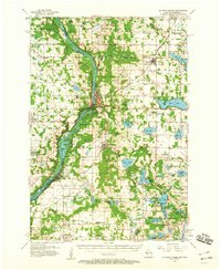
1955 Map of Milltown
USGS Topo · Published 1983About this map
The ST. Croix River forms the western boundary of this 1950s landscape, where the historic Nevers Dam structure remains a prominent landmark near the Minnesota border. The map documents a rural network of small agricultural settlements and hamlets such as Milltown, Trade Lake, and Cushing. This area is characterized by a high density of water bodies, including Spirit Lake, Round Lake, and Wolf Lake, many of which supported early community infrastructure. Rural education and religious life are well-represented by numerous surviving labels for country institutions like Manitou Lake Sch and Bethany Ch. The presence of the Soo Line railroad through the southeastern corner indicates the importance of rail transport for the local dairy and timber economies during this era.
Find a feature on this map
97 named features on this map. Tap any name to fly to it.
Don’t see what you’re looking for? This feature index may not catch every label — zoom into the map to look around manually.
Map Details
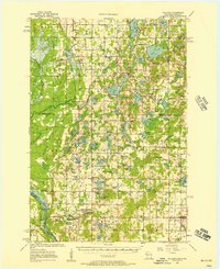
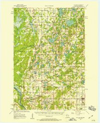
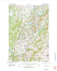
Editions of this 1955 Milltown Map
4 editions found
Other maps of this area

1900 · St Croix Dalles
USGS Topo · 1:62,500

1901 · St Croix Dalles
USGS Topo · 1:62,500
1950 · Webster
USGS Topo · 1:48,000

1950 · Rush City
USGS Topo · 1:48,000

1950 · Grantsburg
USGS Topo · 1:48,000

1950 · Balsam Lake
USGS Topo · 1:62,500

1951 · Milltown
USGS Topo · 1:48,000
1951 · Frederic
USGS Topo · 1:48,000

1953 · Stillwater
USGS Topo · 1:250,000
1955 · St. Croix Dalles
USGS Topo · 1:62,500