
1955 Map of Milltown
USGS Topo · Published 1957About this map
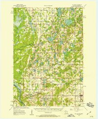
Polk County dairy lands and glacial lake clusters dominate this mid-century survey of the Wisconsin-Minnesota border region. The landscape is characterized by a dense network of rural school districts, including Alabama Sch, Trap Rock Sch, and Branstad Sch, which served the scattered farming communities of Laketown and Eureka. The village of Milltown stands as a primary local hub in the southeast, while smaller settlements like West Denmark and Cushing dot the interior. Water is the defining natural feature here, with a massive concentration of named basins like Spirit Lake, Manitou Lake, and Negro Lake. The intricate hydrology, which includes the meandering Wolf Lake and the Trade River corridor, influenced the early placement of community landmarks like Bethany Ch and several local Gravel Pits, indicating the region's reliance on both agriculture and local geology during this era of rural development.
Find a feature on this map
101 named features on this map. Tap any name to fly to it.
Don’t see what you’re looking for? This feature index may not catch every label — zoom into the map to look around manually.
Map Details
Editions of this 1955 Milltown Map
4 editions found
Other maps of this area

1900 · St Croix Dalles
USGS Topo · 1:62,500

1901 · St Croix Dalles
USGS Topo · 1:62,500

1950 · Webster
USGS Topo · 1:48,000

1950 · Rush City
USGS Topo · 1:48,000

1950 · Grantsburg
USGS Topo · 1:48,000

1950 · Balsam Lake
USGS Topo · 1:62,500

1951 · Milltown
USGS Topo · 1:48,000

1951 · Frederic
USGS Topo · 1:48,000

1953 · Stillwater
USGS Topo · 1:250,000

1955 · St. Croix Dalles
USGS Topo · 1:62,500