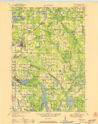
1951 Map of Frederic
USGS Topo · Published 1951About this map
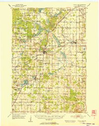
The Minneapolis St Paul and Sault Ste Marie Railroad serves as a central spine through this mid-century landscape, connecting the village of Frederic with Luck, Milltown, and Lewis. The terrain is defined by a dense concentration of water bodies, from the prominent Big Butternut Lake to smaller features like Coon Lake, McKenzie Lake, and the Clam Falls Flowage.
Find a feature on this map
94 named features on this map. Tap any name to fly to it.
Don’t see what you’re looking for? This feature index may not catch every label — zoom into the map to look around manually.
Map Details
Editions of this 1951 Frederic Map
This is the sole edition of this map. No revisions or reprints were ever made.
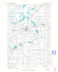
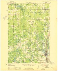
Other maps of this area

1900 · St Croix Dalles
USGS Topo · 1:62,500

1901 · St Croix Dalles
USGS Topo · 1:62,500

1949 · Hertel
USGS Topo · 1:48,000
1950 · Webster
USGS Topo · 1:48,000

1950 · Grantsburg
USGS Topo · 1:48,000

1950 · Balsam Lake
USGS Topo · 1:62,500
1950 · Turtle Lake
USGS Topo · 1:62,500
1951 · Cumberland
USGS Topo · 1:48,000

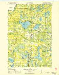
1951 · Milltown
USGS Topo · 1:48,000
1952 · Turtle Lake
USGS Topo · 1:62,500