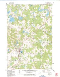
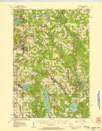
1983 Map of Frederic
USGS Topo · Published 1983About this map
Frederic serves as the primary hub in this northwestern Wisconsin landscape, where the Soo Line railroad bisects the terrain on its way toward Lewis. The town's infrastructure is well-defined, featuring the Municipal Hospital, a Boat Ramp on Coon Lake, and the Frederic Cem. The surrounding townships of West Sweden and Luck are characterized by a dense network of glacial lakes, including Hunters Lake, Blom Lake, and Diamond Lake, many of which are connected by the winding paths of the Trade River and Wood River. The map captures a moment of established rural life, noting local landmarks like the Fish Hatchery near the Clam River and the Frederic Lookout Tower. Numerous gravel pits scattered across the quadrangle suggest the importance of local material extraction for the area's road network, which includes named routes like Dunham Lake Rd and Shuttle Worth Rd.
Find a feature on this map
64 named features on this map. Tap any name to fly to it.
Don’t see what you’re looking for? This feature index may not catch every label — zoom into the map to look around manually.
Map Details
Editions of this 1983 Frederic Map
This is the sole edition of this map. No revisions or reprints were ever made.
Other maps of this area
1950 · Webster
USGS Topo · 1:48,000

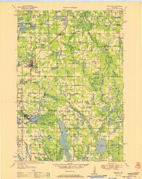
1950 · Grantsburg
USGS Topo · 1:48,000

1951 · Milltown
USGS Topo · 1:48,000
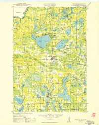
1951 · Frederic
USGS Topo · 1:48,000

1953 · Stillwater
USGS Topo · 1:250,000
1955 · Webster
USGS Topo · 1:62,500
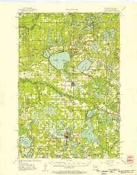
1955 · Frederic
USGS Topo · 1:62,500
1955 · Milltown
USGS Topo · 1:62,500

1955 · Stillwater
USGS Topo · 1:250,000

1958 · Stillwater
USGS Topo · 1:250,000