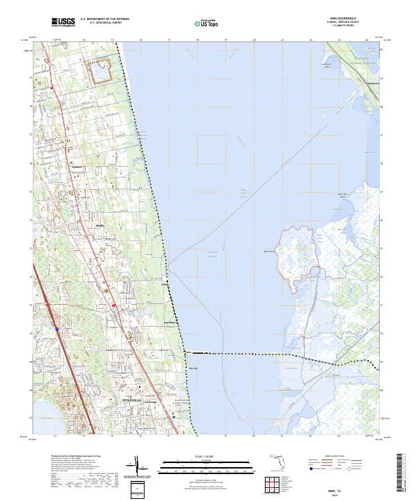
2024 Map of Mims
USGS Topo · Published 2024About this map
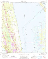
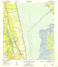
The Indian River Lagoon and its adjacent coastal communities define this section of the Atlantic coast. The transition from rail to trail is evident in the East Central Regional Rail Trl, which cuts through the residential landscape of Mims and Turnbull. This corridor provides a window into the historical transportation network that once connected these northern Brevard settlements. Along the shoreline, the Intracoastal Waterway snakes through the lagoon, flanked by the sprawling Merritt Island National Wildlife Refuge to the east and the northern reaches of Titusville to the south.
Find a feature on this map
150 named features on this map. Tap any name to fly to it.
Don’t see what you’re looking for? This feature index may not catch every label — zoom into the map to look around manually.
Map Details
Editions of this 2024 Mims Map
This is the sole edition of this map. No revisions or reprints were ever made.