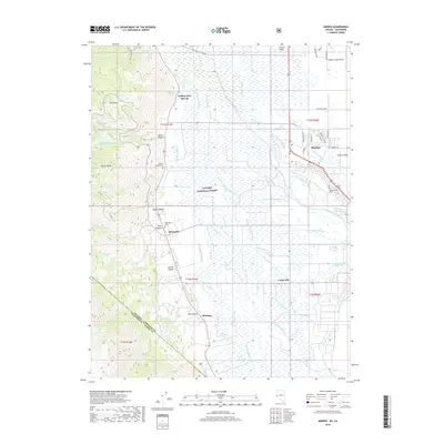
2018 Map of Minden
USGS Topo · Published 2018About this map
Minden and the surrounding Carson Valley floor are defined by an intricate network of irrigation and drainage as seen in this 2018 survey. The landscape is a hydraulic grid where the West Fork Carson River and East Fork Carson River feed a complex system of sloughs and ditches, including the Brockliss Slough, Henningson Slough, and the Heise-Company Ditch. This water management supports the agricultural character of settlements like Centerville and Sheridan.
Find a feature on this map
57 named features on this map. Tap any name to fly to it.
Don’t see what you’re looking for? This feature index may not catch every label — zoom into the map to look around manually.
Map Details
Editions of this 2018 Minden Map
This is the sole edition of this map. No revisions or reprints were ever made.
Other maps of this area

1889 · Markleeville
USGS Topo · 1:125,000

1891 · Carson
USGS Topo · 1:125,000

1891 · Markleeville
USGS Topo · 1:125,000

1893 · Carson
USGS Topo · 1:125,000

1893 · Markleeville
USGS Topo · 1:125,000

1948 · Walker Lake
USGS Topo · 1:250,000
1955 · Freel Peak
USGS Topo · 1:24,000

1955 · Bijou
USGS Topo · 1:24,000

1955 · Glenbrook
USGS Topo · 1:24,000

1956 · Freel Peak
USGS Topo · 1:62,500