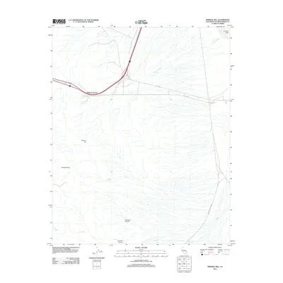
2012 Map of Mineral Hill
USGS Topo · Published 2012About this map
Wheaton Springs sits at the junction of modern infrastructure and traditional desert waypoints in this San Bernardino County landscape. The area is defined by significant topographical landmarks such as Mineral Hill and Kokoweef Peak, with the latter overlooking the deep recesses of Kokoweef Canyon. The presence of Wheaton Spring and Mineral Spring highlights the critical importance of water sources in this arid environment, where intermittent drainages like Wheaton Wash and Oro Wash dictate the flow of the terrain toward the dry bed of Ivanpah Lake in the northeast.
Find a feature on this map
13 named features on this map. Tap any name to fly to it.
Don’t see what you’re looking for? This feature index may not catch every label — zoom into the map to look around manually.
Map Details
Editions of this 2012 Mineral Hill Map
This is the sole edition of this map. No revisions or reprints were ever made.
Other maps of this area

1910 · Ivanpah
USGS Topo · 1:250,000

1912 · Ivanpah
USGS Topo · 1:250,000

1942 · Ivanpah
USGS Topo · 1:250,000

1947 · Kingman
USGS Topo · 1:250,000

1948 · Kingman
USGS Topo · 1:250,000

1954 · Kingman
USGS Topo · 1:250,000

1955 · Kingman
USGS Topo · 1:250,000

1955 · Mescal Range
USGS Topo · 1:62,500

1955 · Roach Lake
USGS Topo · 1:62,500

1956 · Ivanpah
USGS Topo · 1:62,500