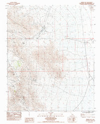
1983 Map of Mineral Hill
USGS Topo · Published 1983About this map
The Clark Mountain Range and Mescal Range dominate this high-desert terrain in the early 1980s, revealing a landscape defined by industrial extraction and arid-land navigation. The Carbonate King Mine sits near the western edge of the quadrangle, illustrating the area's history of mineral prospecting. Below the peaks, the vast Ivanpah Valley opens to the east, home to a Dirt Landing Strip and a portion of Ivanpah Lake at the northeastern corner. Water management is a critical theme of this survey, evidenced by the presence of a Pipeline and Underground Water Pipeline cutting through the valley. Reliable water sources like Wheaton Spring and Mineral Spring are essential landmarks in a region carved by seasonal drainages such as Wheaton Wash, Horse Wash, and Yorkshire Canyon. This provisional edition captures the corridor of Interstate 15 as it facilitates modern passage through this historical mining territory.
Find a feature on this map
20 named features on this map. Tap any name to fly to it.
Don’t see what you’re looking for? This feature index may not catch every label — zoom into the map to look around manually.
Map Details
Editions of this 1983 Mineral Hill Map
This is the sole edition of this map. No revisions or reprints were ever made.
Other maps of this area

1910 · Ivanpah
USGS Topo · 1:250,000

1912 · Ivanpah
USGS Topo · 1:250,000

1942 · Ivanpah
USGS Topo · 1:250,000

1947 · Kingman
USGS Topo · 1:250,000

1948 · Kingman
USGS Topo · 1:250,000

1954 · Kingman
USGS Topo · 1:250,000

1955 · Kingman
USGS Topo · 1:250,000

1955 · Mescal Range
USGS Topo · 1:62,500

1955 · Roach Lake
USGS Topo · 1:62,500

1956 · Ivanpah
USGS Topo · 1:62,500