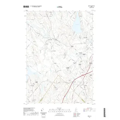
2021 Map of Minot
USGS Topo · Published 2021About this map
Auburn serves as a primary hub in this corner of Maine, where the Little Androscoggin River winds through a landscape defined by historic industrial crossroads and established family settlements. The river is a central feature, passing through the Little Androscoggin River Reservoir and powering several named mills, including Hackett Mills and Stevens Mill. The rail-influenced geography is evident at Lewiston Junction and Rumford Junction, marking points where transportation infrastructure shaped the growth of local neighborhoods like Marston Corner and Littlefield Corner.
Find a feature on this map
65 named features on this map. Tap any name to fly to it.
Don’t see what you’re looking for? This feature index may not catch every label — zoom into the map to look around manually.
Map Details
Editions of this 2021 Minot Map
This is the sole edition of this map. No revisions or reprints were ever made.
Other maps of this area

1892 · Freeport
USGS Topo · 1:62,500

1894 · Gray
USGS Topo · 1:62,500

1898 · Gray
USGS Topo · 1:62,500

1908 · Poland
USGS Topo · 1:62,500

1908 · Lewiston
USGS Topo · 1:62,500

1940 · Poland
USGS Topo · 1:62,500

1941 · Freeport
USGS Topo · 1:62,500

1942 · Lewiston
USGS Topo · 1:62,500

1942 · Poland
USGS Topo · 1:62,500

1942 · Gray
USGS Topo · 1:62,500