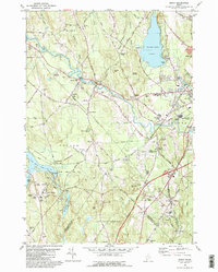
1981 Map of Minot
USGS Topo · Published 1981About this map
The Little Androscoggin River winds through this 1981 landscape, connecting the industrial outskirts of Auburn with smaller settlements like Hackett Mills and East Poland. This era shows a community in transition, where old transportation corridors like the Canadian National and Maine Central railroads intersect with the modern expansion of the Auburn-Lewiston Municipal Airport. The map is particularly rich in genealogical data, documenting numerous rural burying grounds including Mt Auburn Cem, Lane Cem, and Ricker Cem.
Find a feature on this map
75 named features on this map. Tap any name to fly to it.
Don’t see what you’re looking for? This feature index may not catch every label — zoom into the map to look around manually.
Map Details
Editions of this 1981 Minot Map
This is the sole edition of this map. No revisions or reprints were ever made.
Other maps of this area

1892 · Freeport
USGS Topo · 1:62,500

1894 · Gray
USGS Topo · 1:62,500

1898 · Gray
USGS Topo · 1:62,500

1908 · Poland
USGS Topo · 1:62,500

1908 · Lewiston
USGS Topo · 1:62,500

1940 · Poland
USGS Topo · 1:62,500

1941 · Freeport
USGS Topo · 1:62,500

1942 · Lewiston
USGS Topo · 1:62,500

1942 · Poland
USGS Topo · 1:62,500

1942 · Gray
USGS Topo · 1:62,500