2021 Map of Miranda
USGS Topo · Published 2021About this map
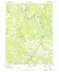
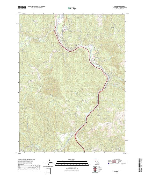
Miranda and Phillipsville serve as the primary human anchors in this coastal redwood corridor, where the South Fork Eel River carves a deep path through the canyon. The famous Ave Of The Giants follows the river's western bank, threading through small groves and local landmarks like Coombs Field and Stephens Grove Tr. The landscape is defined by its steep tributary drainage systems, including Salmon Creek and Hooker Cr, which flow from high points like Bear Buttes and Mail Ridge. This mapping of the terrain illustrates the relationship between the narrow valley floor and the surrounding ridges, where features such as Marshall Opening punctuate the heavily wooded slopes. The grid of forest and ranch roads, from Bear Butte Rd to Logan Rd, reveals the access patterns used for managing this timber-rich and ecologically significant portion of the North Coast.
Find a feature on this map
83 named features on this map. Tap any name to fly to it.
Don’t see what you’re looking for? This feature index may not catch every label — zoom into the map to look around manually.
Map Details
Editions of this 2021 Miranda Map
This is the sole edition of this map. No revisions or reprints were ever made.